Remmel, Amphitheater, Cathedral, and Apex in the Pasayten

Myself, Jessica, Claire, Kelsey, and Denise

We had a delightful opportunity to make a 6-day trip into the Pasayten. The highly praised granite multipitch trad routes in the vicinity of Upper Cathedral Lake were the main draw for me, and I’m very stoked and grateful that we got to climb the two that we did: Pilgrimage to Mecca (4 pitches), and Cathedral’s SE Buttress (10 pitches.) While both were rated 5.9 in the beta we had going in, I found them both to be burly and surprisingly sustained for an alpine climb, and I think a 5.10a rating would better set expectations about the climbing there.

What we did

  • Day 0 – 5 hour drive from Seattle, dinner in Winthrop, slept in our cars at the trailhead
  • Day 1 – Thirtymile Trailhead to Four Point Lake (14 miles, 3800′ gain)
  • Day 2, part 1 – Summit Remmel with light packs (4 miles r.t., 1800′ gain, class 1 scramble)
  • Day 2, part 2 – move camp from Four Point Lake to Upper Cathedral Lake (10 miles, 2200 gain)
  • Day 3 – climb “Pilgrimage to Mecca” (5.9+, 4 pitches) and summit Amphitheater
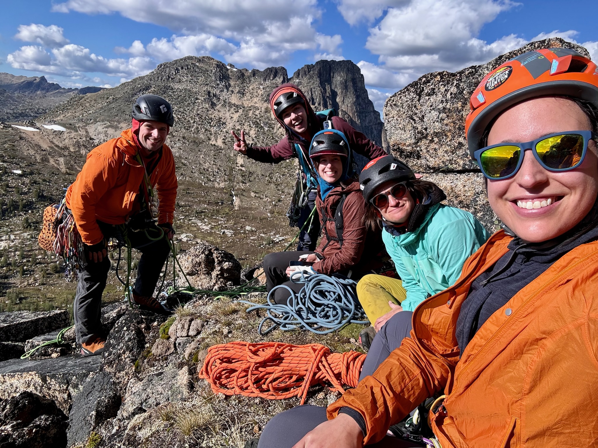
  • Day 4 – climb Cathedral via the SE Buttress (5.10a, 10 pitches)
  • Day 5 – side trip to summit Apex (2 miles r.t., 1000′ gain, class 1) while moving camp from Cathedral Lake down to junction camp (12 miles, 1000′ gain; so total 14 miles, 2000′ gain)
  • Day 6 – Finish the remaining miles to exit (8 miles), lunch in Winthrop, 5 hour drive back to Seattle

I’m not saying that’s the optimal plan, it’s just what we chose to do. It worked pretty well for us. There’s a lot of potential different plans that could be made, adding or removing days.

Map of the Area

https://caltopo.com/m/KS479T7

👆 I’ve put this caltopo map together after the fact, including the GPS tracks I recorded during each of our days, plus some additional route-possibilities we considered but didn’t end up travelling on this trip. I saved waypoints at quite a few trailside campsites & water sources that noticed while out there, and I’ve marked each of those on that map as well. There are definitely more established campsites & water sources out and about out there than the ones I managed to mark, these are just the ones I managed to note.

Near Cathedral Pass, looking at western arm of Ampitheater Mountain, and the Upper Cathedral Lake basin.
Continue reading

Liberty Bell – Beckey Route

I recently had a chance to reclimb this old classic, and figured while the details were fresh in my mind, I might as well write up a detailed guide for anyone doing it for the first time. Of all the routes The Mountaineers club considers “Intermediate Alpine Rock” climbs, this is the shortest and easiest, though it is a notable step up from a Basic Rock climb with a decent amount of sustained 5.6. If you’re feeling good leading 5.6-ish / 5.7-ish trad, and have practiced leading pitches on a number of other multipitches (like many of the Leavenworth classics) so that your efficiency is good and you’re not going to hold up people behind you too much, this could be a good first alpine trad climb beyond the Mountaineers Basic routes.

tl;dr / minimalist-beta

The two least-intuitive route-finding parts worth bringing photos of are: (1) where to start the first pitch, shown here, and (2) finding the rappels on the descent, shown in this overview photo, and this photo of the chains. The rest of this page is an over-abundance of information, more than you really need, so if you’re an experienced alpine trad climber, you’d probably be fine if you ignored the rest and only saved copies of those three linked images to have with you for reference.

Overview

  • Of course, First Ascent by Fred Beckey, in 1946. (26 years before Hwy 20 connected all the way through!!)
  • Season: The route is likely in good climbing shape app all summer, from whenever Hwy 20 opens in May, through early October, until the first snowfall shuts it down.
  • If snow is present, bring ice axe & crampons for the approach gully.
  • 5.6 (5.6 is the original rating, though by modern standards I’d call it more like 5.6+ or 5.7-. It’s fairly sustained too. And as I’m sure you’ve found out by now, sustained-old-school-alpine-trad 5.6 roughly equates to 5.10b or 5.10- by indoor-climbing-gym status.)
  • 4 pitches (Arguably just three-and-a-half pitches. 1st pitch is 5.5 and <100′. 2nd & 3rd pitches each have specific-cruxes but also sustained 5.6 elsewhere and are long, both >100′. 4th pitch has a 12′ friction-slab problem to boulder up, but is otherwise just 3rd class scrambling.)
  • The rappel-route is different than the climbing-route, but not by much, so it’s only minorly committing. Once you’re past the early-crux of the 2nd pitch, you’ll need to finish at least the 2nd & 3rd pitches in order to access the rappel-route to bail without sacrificing a part of your trad-rack.
  • Time-wise, I’d say par-for-the-course is 9 hours car-to-car, so I’d aim to keep your time under that. (Though I could also see problems like particularly-unfavorable snow conditions, or a particularly large crowd of people, potentially making it a 12-hour car-to-car day.) Also be aware that this route is very, very popular. It’s worth starting early, to either be first on the route, or at least be relatively-early-in-line amongst the people at the base waiting to climb it.
  • The trailhead is the Blue Lake Trailhead. (Display a NW Forest Pass or America The Beautiful Pass.) If you live in Seattle, that drive takes 3h10m with no traffic, and could potentially even be 4 hours of driving-time if rush-hour times are involved. To get a sufficiently early start, I recommend driving out the afternoon/evening before, and doing some low-profile camping right in the parking lot of some trailhead nearby. Either sleep inside your car; or if you use a tent or bivy bag, do so on a durable surface like the parking lot itself, set it up after 8pm and break it down before 6am, and it’s pretty unlikely that any ranger will see or care. You could do this in the Blue Lake TH itself, but it is both one of the smallest and one of the busiest, so I often find it more pleasant to disperse to some other trailhead in the area to sleep, then drive the short remainder to the Blue Lake TH in the morning. (Also, top up your car’s gas tank right after leaving I-5 via exit 208 onto Hwy 530, or at least don’t go beyond Marblemount with less than half a tank.)
Continue reading

Eldorado, NW Couloir – 2024

At long last!! After six years of trying, dozens & dozens of good-weather-windows looked at but ruled out due to some other conditions problem or lack of partners, and four other previous “perfect opportunity” attempts made but turned around: Finally. I have finally climbed that darn couloir, on the weekend of April 13th & 14th. It proved to indeed be the most difficult alpine climb I have done in my life to date.

Continue reading

Mount Stuart’s West Ridge

Mount Stuart is my favorite mountain, and has been for a long time. Way back when I was just a hiker & backpacker, I loved the look of it, it was so imposing. Unknowingly influenced by the way things appear steeper than they really are when viewed face-on from far away, I never imagined it was something I’d ever actually be able to go up. Then, early in my mountaineering career, on the first weekend of June 2012, my mentor Karl took me up the Cascadian Couloir to the summit, blowing my mind about what was possible as a “scramble”. A heavy snowpack back then even made the Cascadian Couloir oddly delightful: solid kick-stepping the whole way up, and it was the second-best long glissade of my life going back down, second only to the south side of Adams the year prior. (Though the climate has changed noticeably since then, and it would be much more difficult to see enough lasting snow for glissade conditions like that on Stuart ever again.) Since then, I’ve now been to the summit of Stuart five different times, all of which are very memorable to me, and three of which have been via the West Ridge. Given the complicated route-finding of the West Ridge, I wanted to put some notes out there for the benefit of friends who have yet to climb it.

Worth noting: My advice in this post (well, true for any post!) is one way of doing the West Ridge. It’s not the only way, there are countless other right answers out there. This just happens to be the way I typically do it.

Continue reading

The Dirty

tl;dr version

7 pitches, some climbing up to 5.8, and a walk-off with one rappel. Gear to 3″.
9 hours car-to-car at an unhurried pace. A slightly-chillier-than-expected wind is typical on this wall.
Routefinding is intuitive except: Pitch 4 bolted-anchor is to your right, easy to miss, just before passing half-rope on a 60m rope. Pitch 5 ends in a deep notch, requires a trad-gear anchor.
https://www.mountainproject.com/route/119210014/

Continue reading

Skookum Falls

I’m so stoked that I finally got to actually climb an ice route!! It’s been just shy of 3 years. And not for lack of trying, I’ve just had so many turn-arounds and cancellations. Anyway, with Seattle itself being below freezing since Sunday, I was very optimistic about the chances of finding Skookum Falls in shape for climbing. I got Chris to go out there with me yesterday, Wednesday Dec. 29th, and the ice did indeed deliver!

Continue reading

Eldorado, NW Couloir

Ugh, this route!  I’m 0 for 3 on it.  This past weekend, Nov. 20th & 21st, was my third attempt, and third turnaround.

tl;dr

At least as of Nov. 21st, the Cascade River Road is indeed drivable to milepost 20, the normal summer trailhead for Eldo. (And gated after that.) The log crossing has changed again already (at least since this past April.) We used a smaller log that’s about 150′ downstream from where the river is closest to the road, which worked out just fine. (Not that you need coordinates for it, but if it makes you feel better: 48.493061, -121.123988) It’ll probably be different again by next spring.

Continue reading

Chair Peak, NE Buttress, winter

February 26, 2016

At last!!  This was the 6th time I had blocked out a date on the calendar to climb this route in winter conditions, but it was the first time that I didn’t have to cancel it due to poor avalanche conditions or poor weather.  We finally did it, and we actually summited!  It helped that I had also done this route during the summer as a rock climb (Sept. 4, 2015) so I was already familiar with the route & approach.  This has also convinced me that if you want to do this route in the winter (or most any winter climb) scheduling it far in advance and crossing your fingers for good conditions is futile, don’t do it.  Instead, build a list of like-minded climbing partners you can call on, all of whom are interested enough in the route that they’ll take a vacation day on short notice to do it.  Wait for the good weather and safe avalanche conditions to come first, then schedule the climb opportunistically.  Personally, I wouldn’t do this climb unless NWAC predicts “Moderate” danger or lower.  If you see three consecutive days of no precipitation coming down the pipeline in the weather forecast, odds are you’ll have stable enough avy conditions to climb during that third day.  Still, confirm NWAC’s forecast before you go, and make good decisions for yourself. Continue reading

East Ridge of Forbidden

We planned a two-day climb of Forbidden’s East Ridge Direct for August 22nd & 23rd.  The idea was to bivy high Saturday night, close to the Solitary Gendarme, then run up the East Ridge Sunday morning, descend via the East Ledges, pack up and head home Sunday night.  We had a very strong four person team:  Scott McAmis, David Wittstock, Sherrie Trecker, and myself (Rob Busack.)  Scott had very kindly gone up a day ahead of time to get a Boston Basin camping permit for us. Continue reading