There are quite a few possible routes to the summit of Argonaut Peak. Far from a complete list, here’s a few:
- “South Route“ often refers to the technically-easiest route, a scramble up from the south, up from the Ingalls Creek valley, from a trailhead in the Teanaway region, where the crux is one 4th-class move which some will want a rope for. That 4th class move is stepping-right at a chockstone, just right of the “South Face,” and is typically descended with one 50-foot rappel. This “South Route” scramble is the route I’ll cover in more detail in the rest of this post.
- “South Face“ often refers to an visually-striking wall at the summit with many possible lines for ~3-pitch rock climbing, where you could probably make it anywhere from 5.3 to 5.10 depending on which line you choose. This clean face of rock is fairly easy to see in any zoomed photograph of Argonaut taken from the south. The “South Face” and the “South Route” have the same approach–whichever one you are doing, you will scramble up to the base of the “South Face” first, then either go straight up it if rock-climbing, or scramble rightward at the base of the face to find the “South Route” gully & chockstone. And either way, the “South Route” down-scramble and rappel is your descent from the summit, so it would be very easy to retrieve any boots/packs/whatever stashed at the base of the “South Face” climbing route.
- “NW Arete” is a rock climbing route that really catches my curiosity, reportedly 5.6 and about 6 pitches. Its location on the north side of the peak is different enough to warrant a completely different approach and trailhead, parking at the Colchuck Lake / Stuart Lake trailhead, passing through the Stuart Lake permit zone of the Enchantments, exiting the border of the permit zone a little before arriving at some high bivy site options. Once the route has been climbed and you’re on the summit, it’s a little unclear what the best descent route should be. Options include a scramble down “arduous steep scree” at a possibly-uncomfortable slope angle that does return to camp; or possibly doing a true carry-over, taking your overnight gear with you on the rock climb, so that you can traverse relatively easy terrain over to Colchuck to exit down that way, loop style. (More notes on the NW Arete later in this post.)
Now to get more back-on-topic of the “South Route”…
South Route, Big Picture Schedule
I’d recommend the typical 2-day climb format: an easy Day-1 approach and make camp, a pre-dawn start on Day-2, summit mid-morning, back to camp mid-day, pack up and hike out by a reasonable afternoon hour.
Here’s the GPX track I recorded for the South Route: https://peakbagger.com/climber/ascent.aspx?aid=2583398
IMO, the standard trailhead for Argonaut’s south side is the Bean Creek / Beverly Creek Trailhead, off of the Teanaway River Road. (It’s certainly not the only option. You could also get there by parking at the Esmeralda / Ingalls Trailhead and going over Longs Pass, and the stats aren’t that different. Or plenty of other creative options. But for simplicity here, I’ll just spell out the version starting from Bean Creek trailhead.)
- Day 1 [Strava]
- Drive to Bean Creek / Beverly Creek Trailhead (2h30m drive from Seattle)
- Hike to camp – 6 miles, 2000′ gain, 1350′ loss – typically 3 hours
- at 0.5 miles in, turn left to take Trail 1391, the Beverly Turnpike trail
- at 3.1 miles in, turn right to take Trail 1226.1 (the intersection is subtle)
- at 3.6 miles in, the top of the pass for Fourth Creek, with the first views out at Argonaut, Colchuck, Dragontail, & Little Annapurna. Keep left to be on the Fourth Creek trail.
- at 6 miles in, the Fourth Creek trail crosses Ingalls Creek (either wade, or look around for a possible footlog, there was feasible one just 30′ downstream in 2024.) Immediately on the other side of the stream are campsites. Camp is at 4200′.
- Day 2 [Strava] (ballpark ~13 hours to the car)
- camp to summit – gain 4200′ – likely 5 hours total up: 4 hours to bushwack & scramble up to the base of the South Face, then plus 1 hour to rope up, lead the 50′ gully with the 4th class move, get everyone up it, and finish the scramble onto the summit
- we hung out on the summit for 30 minutes
- summit to camp – descend 4200′ – likely 4 hours total down: 30 minutes for everyone to rappel, 3h30m to descend
- 1 hour to pack up camp
- 2h30m hike out (re-gain 1350′ on the hike out, though the moderate trail through forest made it feel a tad less harsh than Longs Pass often feels.)
Alternatively, if you really wanted to do this in a single-day-push, I could see that being feasible. It just sounds a little rough for a couple of reasons: Carrying a rope somewhat hampers the runnability of the trail miles, and north of Ingalls Creek, you’re not running anyway because so much of it is bushwack or scramble; so I’m not sure it would be all that much faster. I think it would be something like 16 hours car-to-car, and that would get extra-rough if something went wrong. But no doubt there are people out there who will comfortably do it in a day, so if that’s what you want to do, go for it.
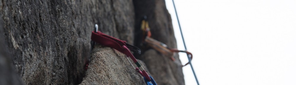
South Route, Gear
The technical-crux of the route is one move of 4th class, stepping-right by a chockstone. That chockstone is at the top of a little 50′ gully that’s all 3rd class moves up until the chockstone. There is comfortable standing-terrain at the bottom of all that, so if you’ve got a rope, it makes the most sense to flake it at the base and belay from there, have someone lead-climb through the 3rd class to make the 4th class move, and finish the pitch at the rappel anchor found immediately above the chockstone. If you’re a party of 2, just belay up the second. If you’re a party of 3 or more, the leader could fix the rope to the anchor up top (e.g. clove hitch on a locker) and all but the last person could self-belay themselves by putting a prusik on that fixed-line.
- as always, helmet
- recommended:
- a scramble-rope, any diameter you’re comfortable rappelling on. I had a 40-meter rope, which was great. I’m fairly sure a 30-meter rope would be just-right too.
- a very light harness, with just enough kit to rappel, (including a prusik to also self-belay with while going up if your party-size is more than just 2 people.)
- recommended “rack”: just 4 double-runners is a plenty sufficient “rack” for this. There are a couple of places in that gully where other, smaller chockstones are solidly wedged, and you can girth-hitch double-runners at their contact-points to fully protect a lead-climber. Optionally, if you really can’t bring yourself not to carry any metal trad gear, you could optionally place a brown tricam (size #1.5), or a green BD #0.75 cam, and/or maybe one adjacent size. (During our climb, I brought just a set of tricams, and found I didn’t really need them at all.)
- Consider bringing one fresh piece of tied webbing or cord to improve the one rappel anchor. Cut away & pack out the worst-looking pieces of tat, and add your one new piece. About an 8-foot length of material should be about right for going around the rock once and tieing a knot.
- season-dependent:
- if there may still be snow anywhere on the approach, definitely bring ice axe & crampons. Some trip reports describe very hard snow high in the approach couloir, so if that is possible, you wouldn’t want to be without the pointy-bits. (Likely any last snow disappears around mid-July on this very-south-facing approach.)
- footwear: If you’re bringing ice axe & crampons, then mountaineering boots may make sense (though light 3-season boots would be slightly preferred over heavier “glacier” boots.) And if you’re bringing mountaineering boots, then you may also want trail-runners for the trail-miles back and forth between trailhead & camp. However, if you’re not bringing ice axe & crampons, that means you’re confident there’s no snow, in which case sticky-rubber approach shoes would make for the ideal footwear for this entire trip. Approach-shoe rubber makes the one 4th class move feel more secure. I’ve seen people do it in soft-rubber trail-runners too, so it’s definitely do-able in trail runners, but the person in trail-runners may feel better about being on top-rope rather than on lead.
- You do NOT need to haul rock-climbing shoes all the way up here for that one move. I do think the rating is right, calling it one 4th class move, and it certainly is a move I’d happily pull in mountaineering boots on lead if I had to.
- optional but recommended: creek-wading shoes can be a nice-to-have. I’m especially a fan of Crocs, as they’re great for both getting in the creek, and for just general comfy wear around camp. The “Forth Creek Trail” crosses Ingalls Creek just before arriving at camp, and that crossing can be easily waded (which some people prefer), or done on a log just downstream (though the log was a little high & bouncy, which some people did not prefer.)
- the usual overnight gear for a creek-side forest camp:
- tent, sleeping bag, pad, etc.
- stove
- water filter
- 50′ cord to hang a bear bag
- if you need to poop while at camp: be sure you’re going at least 200′ away from camp, the creek, and the main Ingalls Lake trail, and then it’s okay to bury. Consider only burying the human-waste, and packing out the used toilet-paper.
(Alternatively, some will ask: do you really need the rope?? My answer: I do think the rating is right, calling it one 4th class move is accurate. An experienced scrambler likely would feel comfortable soloing up it without a rope. The move can be done securely, if you can keep your head cool, though may feel a bit psychological unroped because you’d be looking at a fall of at least 50 feet if you messed up. The harder part though is going down. Of those who feel good going up it without a rope, I think many would end up wanting the rope after all when it’s time to go back down the move. So if you’re going to bring a rope anyway for the rappel, why not just use it during both up and down? Though if you’re really confident in your ability to downclimb something a bit exposed without a rope, then sure, there certainly are people out there who would be fine leaving the rope at home for this. Though if you’re even asking the question, a.k.a. since you’re reading this in search of advice at all, it probably means you should err on the side of bringing the rope, just to prevent any regrets.)
South Route Details
todo, add pictures
Notes on the NW Arete route
I’ve made an attempt on this route before, on August 27, 2022, but got turned around where a key snow finger had already melted away for the season. I haven’t yet found the right conditions+partner+free time line up to try the route again, even though I’d very much like to at some point. So I don’t have first-hand knowledge of the climbing, but I can offer some specifics about the approach, and muse about the options ahead.
The approach parks at the Colchuck Lake / Stuart Lake trailhead, and passes through the Stuart Lake permit zone of the Enchantments. It leaves the official Stuart Lake trail at 4670′, stays below 4700′ to find an unofficial trail that closely parallels Mountaineers Creek (don’t get tempted to ascend into open talus too early, the trail down by the creek is faster.) At 4780′, not far from a major fork in Mountaineers Creek, finally cross the creek and travel south, eventually exiting the permit-area boundary. Here the approach could split into two significantly different options. The most commonly-done is to ascend southeast into the basin that is due-north of Argonaut’s summit, where there are bivy-sites at 6390′, (47.47649, -120.85889), and at 6600′ (47.47512, -120.85989). From that basin, the NW Arete is reached by ascending a key snow-finger that travels climber’s-right (travels southwest) to reach a notch where the NW Arete rock climbing begins at ~7700′. However, when that snow-finger becomes discontinuous (likely late-July?), things get ugly there, with loose and wet mud and gravel on top of steep enough rock that it looked fairly dangerous, and caused us to turn around our 2022 attempt on that route, so going early-season-enough for that snow-finger to be intact is likely a necessity. Or, I did find one report of a party that did a significant variation of this approach: from back in the area of Mountaineers Creek and the permit-area boundary, it is possible to ascend a bit southwest instead, going up into the basin that leads to Sherpa Pass, west of Argonaut Peak itself. Rumors of camping by Mountaineers Creek around 5700′ in that basin, then scrambling southeast-ish to reach the same NW Arete starting notch at 7700′, but from the opposite side. That alternate approach might be less snow-dependent, and might go later in the season. I’d be very curious to learn more.
Which ever way you get to the NW Arete, once you climb it and summit, yet another complicating factor is that it’s unclear what the best descent for this route is. It is clear that a few rappels can be made to the east between 8120′ and ~7900′ (500 feet horizontally further east than the top of the “South Route” chockstone), but it’s unclear what’s best below 7900′. A number of trip reports manage to return to the due-north-basin by scrambling one gully or another, but with descriptors like “arduous steep scree” and things looking pretty steep on a slope-angle map there, I don’t know for sure that it’s the best way. If you needed to return to the western basin, north of Sherpa Pass, it’s certainly theoretically possible to go down and around far enough south then back up and through Sherpa Pass, but it’s unclear just how long that would be, it could be prohibitively long. Perhaps the best idea for a “chill” descent is to truly carry-over, leaving nothing behind at camp, then after summitting & doing the east-rappels, keep going far east on easy terrain to Colchuck Col, and descend from there to Colchuck Lake, and cruise on out via the packed Enchantments-highway trail. Though that last option does mean climbing 5.6 while carrying an overnight pack, which presents its own challenges. (See the “gear” section for West Ridge of Stuart for some thoughts on how to keep overnight gear minimal & light.)
To help you orient, I’ll share this link to a map: https://caltopo.com/m/QBFRE But don’t take that map too seriously, many of the lines are hand-drawn and untested, so don’t assume that every line on that map is passable.
