(Does the world really need another trip report for the hike to Muir? Not really… but here is one anyway 🙂 )
This past Sunday, June 29th, 2014, Eric, Gerry, Jarred, Jon, Ben and I skinned up to Camp Muir on Mt Rainier and then skied down. We had originally planned on doing it on Saturday but weather reports on Friday were calling for rain/snow on Sat and cloudy skies on Sunday so we moved our date. Turns out it was a big mistake to listed to the weather report, as Sat ended up having no rain and Sunday turned out to by foggy and misty mixed with patches of rain. We left Seattle at 6am and started from Paradise (elevation 5,400 ft) around 9:30 am.

Setting Out at Paradise
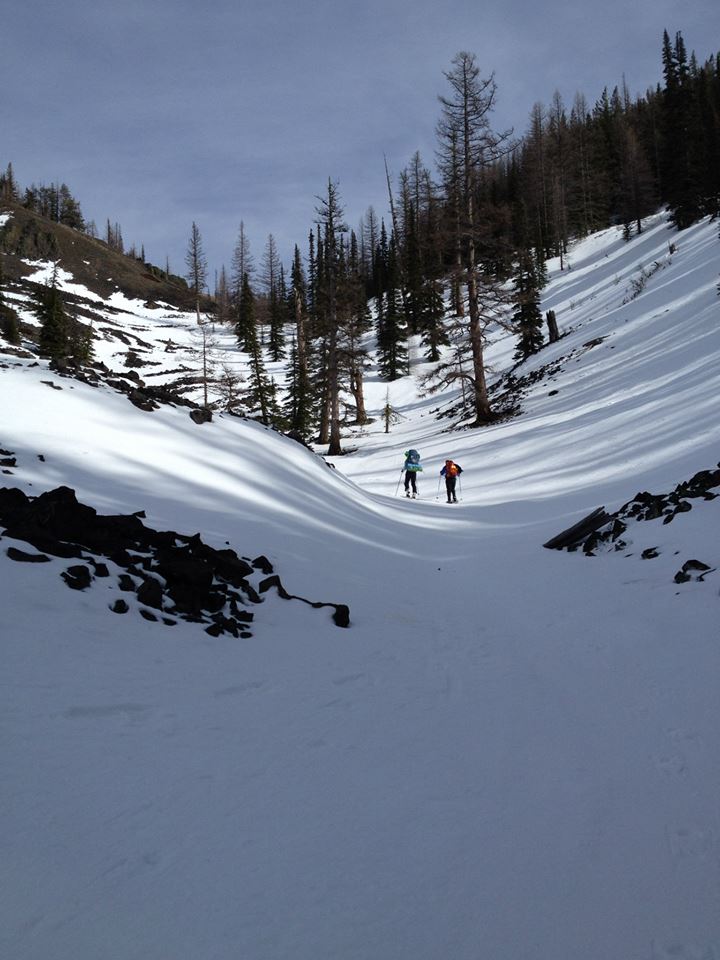
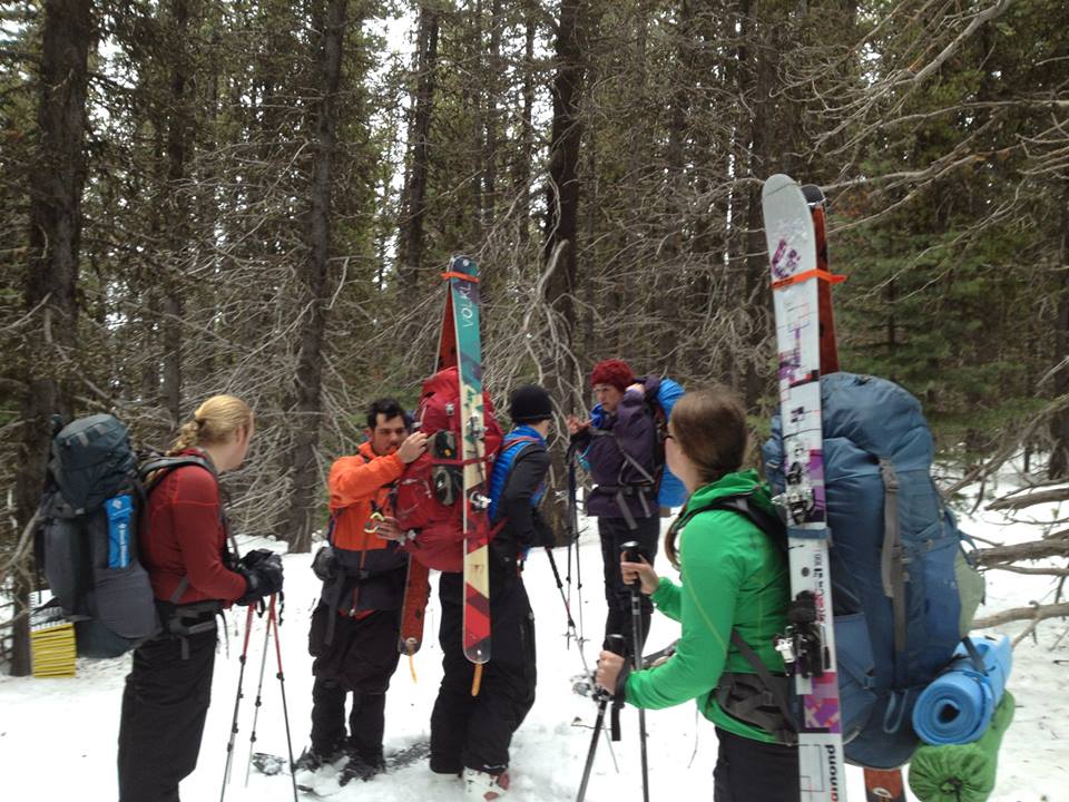
Since the snow reached the parking lot we were able to start out skinning from the very start and we were able to make some pretty good time until we reached Panorama Point (elevation 6,700 ft, distance from paradise 2.5 mi). At this point there were a series of 3 short ski carries, but each transition took some time. Once we were over all 3 transitions it was about noon and we were fully on the Muir Snowfeild. We were also very much ready for lunch. We were also a little over half way up at this point, so refueling was a good idea. Eric and Gerry found a good rock pile and we sat down to nom away. Lunch didn’t last too long, since it was misty and oh so cold, and we got moving after only 20 min. But not too soon for Gerry to not take a short nap 🙂 While eating lunch we saw one of the guided groups (which we had been leap-frogging with all day) slogging up.

Ben going though the first snow to rock transition

Jarred in the fog
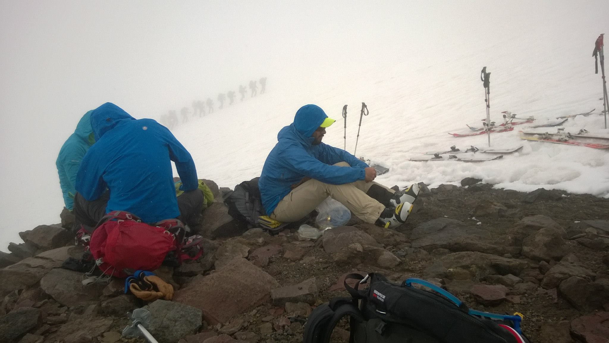
Guided group chugging up the mountain while we eat lunch
After lunch it was a pretty straight shot of about 2000 vertical feet up to Muir. We started running into the early birds who were already descending and kept hearing promises of blue skies at Muir, this was definitely the motivation we needed! Since it was easy going up from our lunch point the group broke up into the fast and slower folks, Gerry, Eric and Jarred reach Camp Muir (elevation 10080 ft) around 2:30, while Jon, Ben and I reach it around 3 (to find Gerry taking his 3rd? nap of the day). The clouds broke maybe 100ft before the camp and we got a few glorious views.

Andrea with Muir in the background

Gerry already napping as Ben arrives at Muir
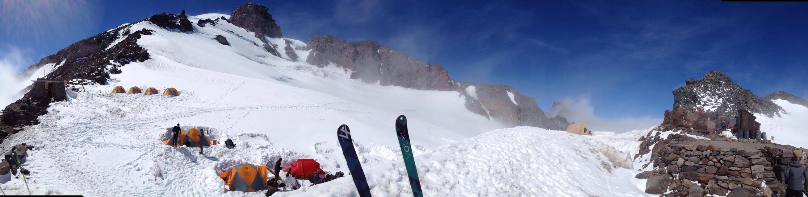
View from Muir
Eric had scouted out an additional add-on that that provided some steep skiing above Muir, and Gerry was up for scoping it out with him. They skinned up the side of the glacier and then dropped back down right below Muir, giving the rest of us about 30 extra minutes to take in the view, chat with climbers milling about, and have a rest. We were ready to roll once they got back down, the clouds were rolling in and the wind was picking up.

Heading down right below Camp Muir
The first 200ft of skiing were fantastic, we were able to ski in some untouched snow before descending into the clouds and fog. The next 2000ft were near whiteout conditions, and we had to stop and regroup about every 100ft, sometimes calling out to one another when we could no longer see. We followed the flags down pretty closely, not wanting to get off route knowing there was a glacier to our right side. By this point the rain had really started to pick up and we stopped and put on rain pants and extra rain gear.
Shortly after while regrouping for maybe the 15th time we heard a voice calling out from the rocks to our left (the ones that are the barrier between the Muir snowfield and yet another glacier) but with the visibility so low we could not see the source of the voice. When we first heard his calls through the fog and rain we thought we heard him calling out that he had broken his leg. We stopped and Jarred and I took off our skis to boot back up to the rocks, then fortunately we heard the voice coming towards us. It turned out to be a solo hiker who had gotten off route and was very lost. We got him back onto the route, pointing out the flags and boot path to follow. We also took his name, details and cellphone number and agreed that we would turn this info over to the ranger station at Paradise and he would check in there when he got down (so they would know a solo hiker was out there.) He wasn’t disoriented and was carry emergency gear (from the size of his pack probably a lot of emergency gear) so we felt o.k. leaving him to hike down alone.
Shorty thereafter we hit the 3 rocky areas with the ski-boot-ski transitions, and at the end of the 3rd the lost hiker had caught up to us. We were all very relived to see him, and at this point the fog had lifted and visibility was much better. There was only about 1000ft to go, so we talked to him and agreed we would not stop at the ranger station.
The last 1000 feet of skiing was super fun, and to make it even more fun Eric broke out his GPS and we split from the trail to ski through the trees and all the way down to the lower parking lot (much more preferable that booting it down from the upper lot!) Once in the lot we changed into dry clothes and we headed to Copper Creek Inn for some dinner, beer, and pie. All in all it was a pretty awesome day with great snow conditions, the only thing that would have made it better was increased visibility… guess we will just have to do it again soon 🙂