
If you are into mountaineering, Sloan Peak is a must-do classic summit. Its distinctive shark-fin shape and rather central location in the Cascade range make it a familiar appearance on the horizon from many other summits. That also means that conversely, when you do summit Sloan, you will be surrounded by a plethora of sightlines to many other familiar mountains in the North Cascades and Alpine Lakes regions, indulging both nostalgia for climbs-past and fueling stoke for climbs-future. And even aside from the views, the route itself is a fun romp on varied terrain, a sampling-platter of many alpine elements, but no part is so spicy that it’s overly stressful, and no part so big that it feels like volcano-slog. Overall, I find it to be delightful day out compared to many other larger or more-stressful alpine climbs. Heck, it could even be a good “first glacier climb” for someone to get experience with their systems on the relatively-short glacier crossing, as long as they’ve got the fitness and scramble-experience to be otherwise ready for the day.

Overview
- The key difficulties are basic glacier travel, and a fair amount of 3rd class scrambling.
- When to go: July & August are the safest bets for finding the route in good condition. Above 7200′, the route makes use of lovely trails on high heather ledges, but with a ~500′ drop over a precipice at the edge of the ledge. Those ledges must be snow-free to be safely passable, so snowcover there will likely turn-around attempts on the summit before late-June. On the other side of summer, you want to go before the glacier crossing gets too broken up. I’m not entirely sure at what point in summer the glacier typically becomes impassable, but my guess is sometime in September. I imagine summits could still be made during September, but the difficulty and technicality of the glacier crossing will go up.
- Summit at 7835′.
- Note that there are two different trailheads / approaches from which Sloan Peak can be accessed. (1) from the north, the “Sloan Peak Trailhead” (a.k.a. “Cougar Creek approach”) at 1919′ elevation, is a pull-off along road FS 49, where the road is better, but the North Fork Sauk River must be crossed, which is a pain at best, or a complete blocker at times of high-water. Or, (2) from the west, the “Bedal Creek Trailhead” at 2790′, which requires driving a pretty awful side-road (FS 4096) to access, but once the drive is done it’s all better from there, starting higher and with no creek to cross. I’ll focus on the approach from the Bedal Creek Trailhead.
- Strava & Peakbagger links for the GPX track.
- Stats: 5300′ of gain, 9.5 miles round trip.
- Par-for-the-course on time is about 13 hours car-to-car. Or notably less if your party is particularly experienced & efficient.
- In my opinion, the best way to do the route is in-a-day, with a car-bivy the night before, so you can start hiking at perhaps 4:00am. (Though if you really wanted to camp out there, you could do so, there’s space for 4 to 6 tents total (consider other parties) at 48.05673, -121.34298, at 5380′, near a pond that’s a bit stagnant.)
- The FS 4096 road is quite bad, you definitely need a 4WD or AWD vehicle to get up it, and a decent bit of ground-clearance would be a good idea too.
Gear
- helmet, as always
- a light glacier-travel kit: a light rope, light harness, just enough bits on the harness that your team could be self-sufficient at crevasse rescue if needed, and a couple pickets
- ice axe & crampons (light aluminum ones are fine, but don’t leave them out, as snowfields on or before the glacier can be very firm before midday)
- probably any footwear that you feel good about will work. The ideal is probably light three-season mountaineering boots, or a pair of hiking-boots that your crampons will fit to.
- a water filter or treatment is a really handy thing to have. There’s a great opportunity to refill all your water just above 5500′, (48.05460, -121.34009), where plenty of little streams of water cascade down.
- the usual 10 Essentials stuff
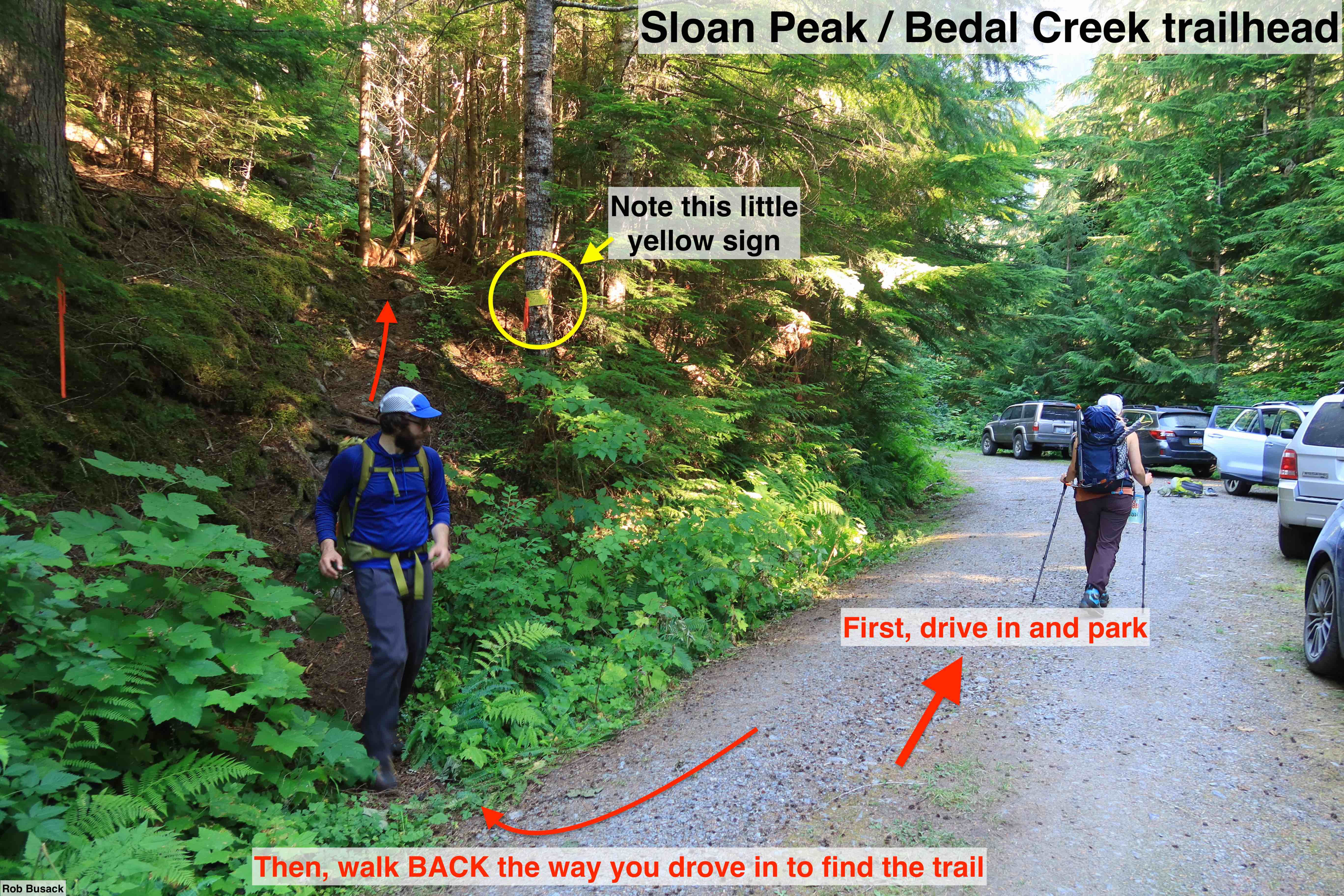
The Road & Trailhead (Important)
Carpooling is a good idea, for quite a few reasons. Obviously to burn less gas, but also to get everyone into the most capable vehicle(s) for the rough road, and also because the trailhead at the end is tiny (less than 10 cars can fit, and this route does get popular on peak summer weekends.)
FS 4096 is an unsigned turn-off from Mountain Loop Hwy, and it’s easy to miss. The turn is at ( 48.0859, -121.3888 ). I recommend creating a waypoint with those coordinates on Gaia Maps or whatever you use for offline-maps on your phone to help you find it while driving.
Once on FS 4096, it goes for about 3 miles before dead-ending at the trailhead, and unfortunately the road is quite bad, especially in its later half. You definitely need a 4WD or AWD vehicle to get up it, and a decent bit of ground-clearance would be a good idea too. My regular Subaru Forester made it just fine, but it is a rough ride, and keeping momentum up is key. In the sections of road that are both steep and majorly potholed, do not stop, it’s crucial to keep your momentum up. If you were to stop, then attempt to start going forward again, your wheels will just spin in place and dig the pothole bigger, and your only hope will be to drive in reverse down the narrow road then try again. You kinda just have to pick your line up the bumpy sections, optimizing for just how off-center you need to drive to likely keep your ties supported, and just go for it, keep that momentum up.
The trailhead parking is where a dirt berm blocks off the road, and it widens enough for maybe seven to nine cars total to park. After you’ve parked, note that the trail itself starts from a bit of an unintuitive spot: you need to walk back towards the direction you came in from, away from the dirt-berm, and find the trail’s start just to the north and east, near the mouth of this little parking lot.
Route Breakdown & Potential Schedule
Obviously, the times here are just light suggestions. Go with whatever start-time and schedule you’d prefer instead.
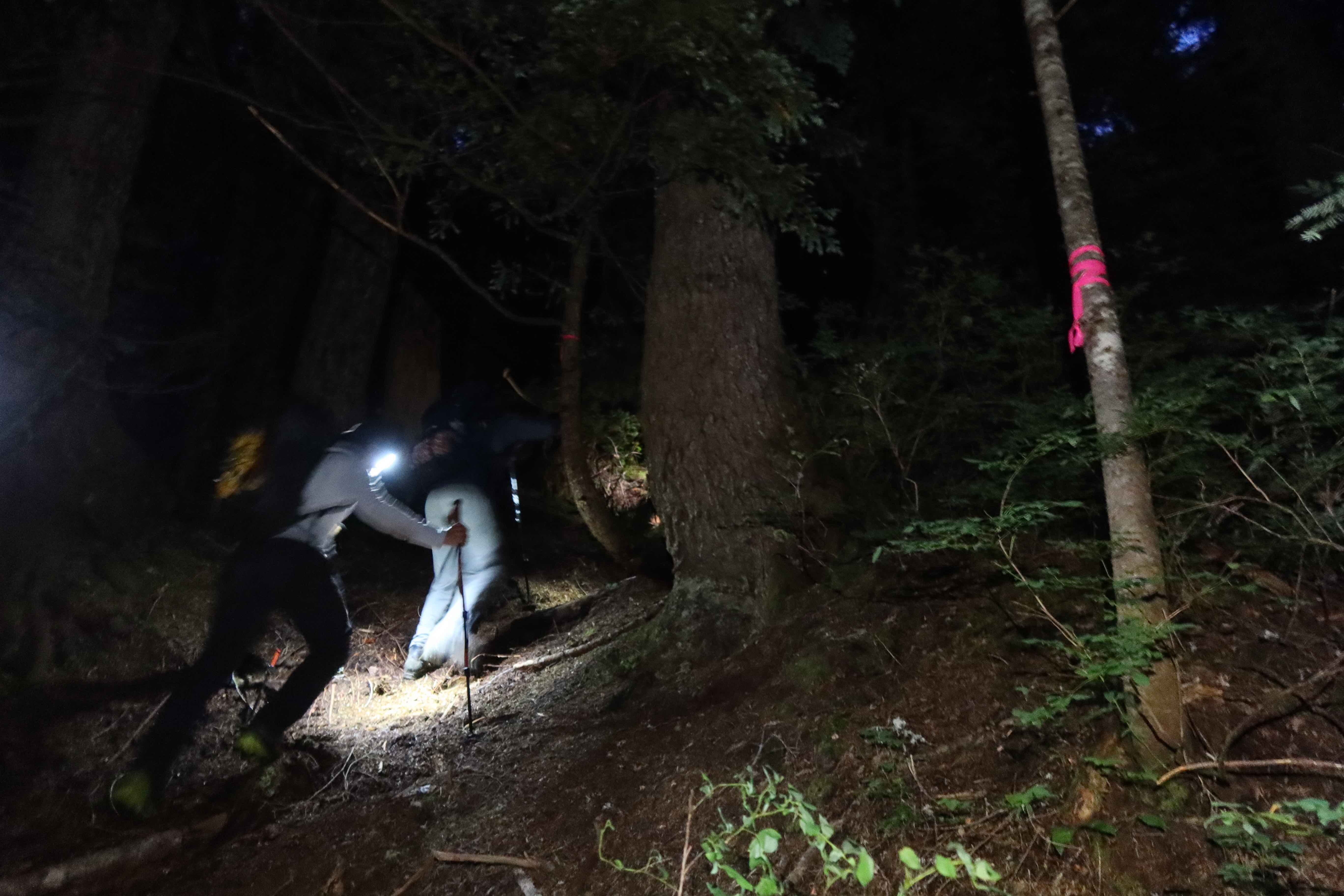
- 2800′ – 4:00am – Trailhead
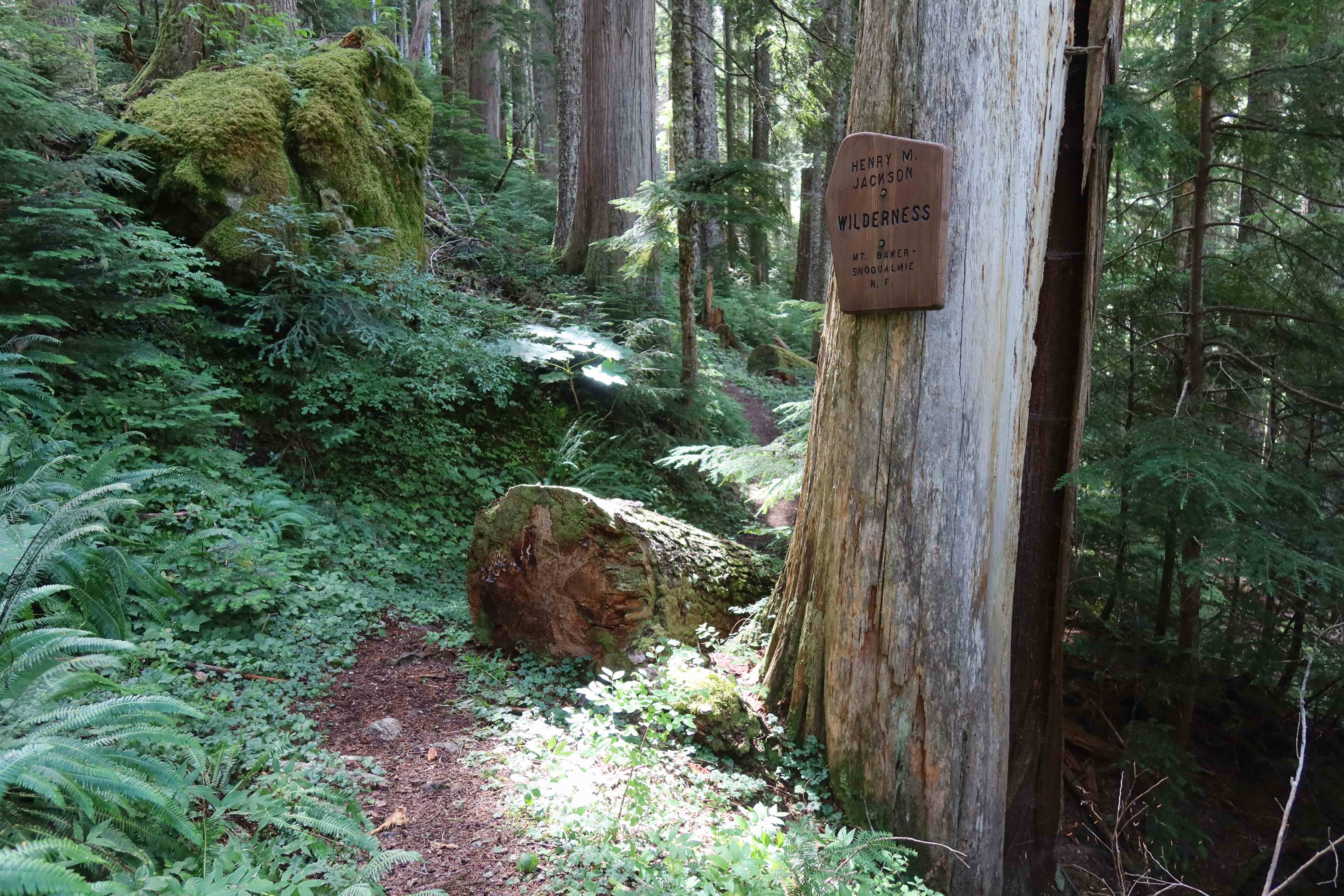
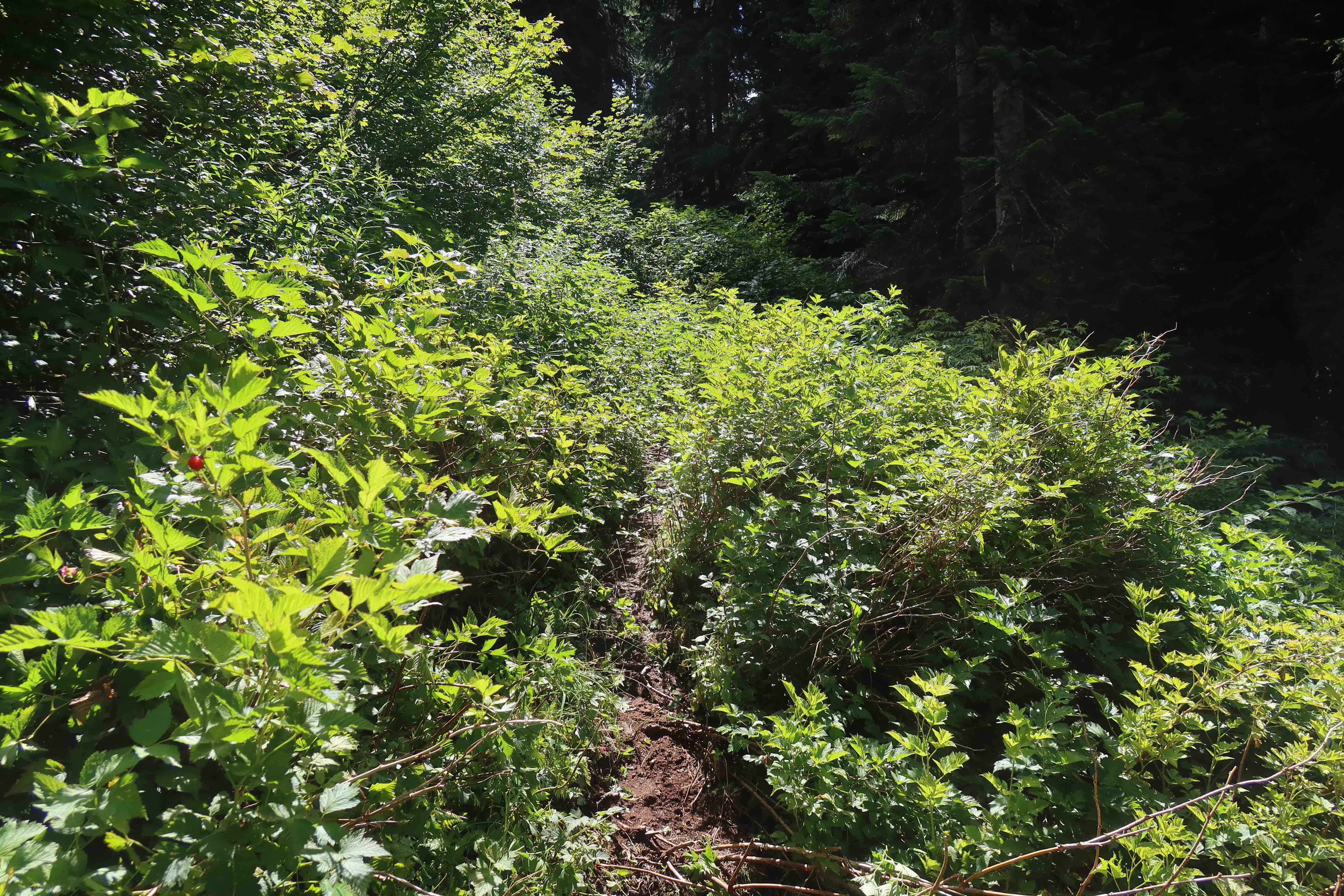
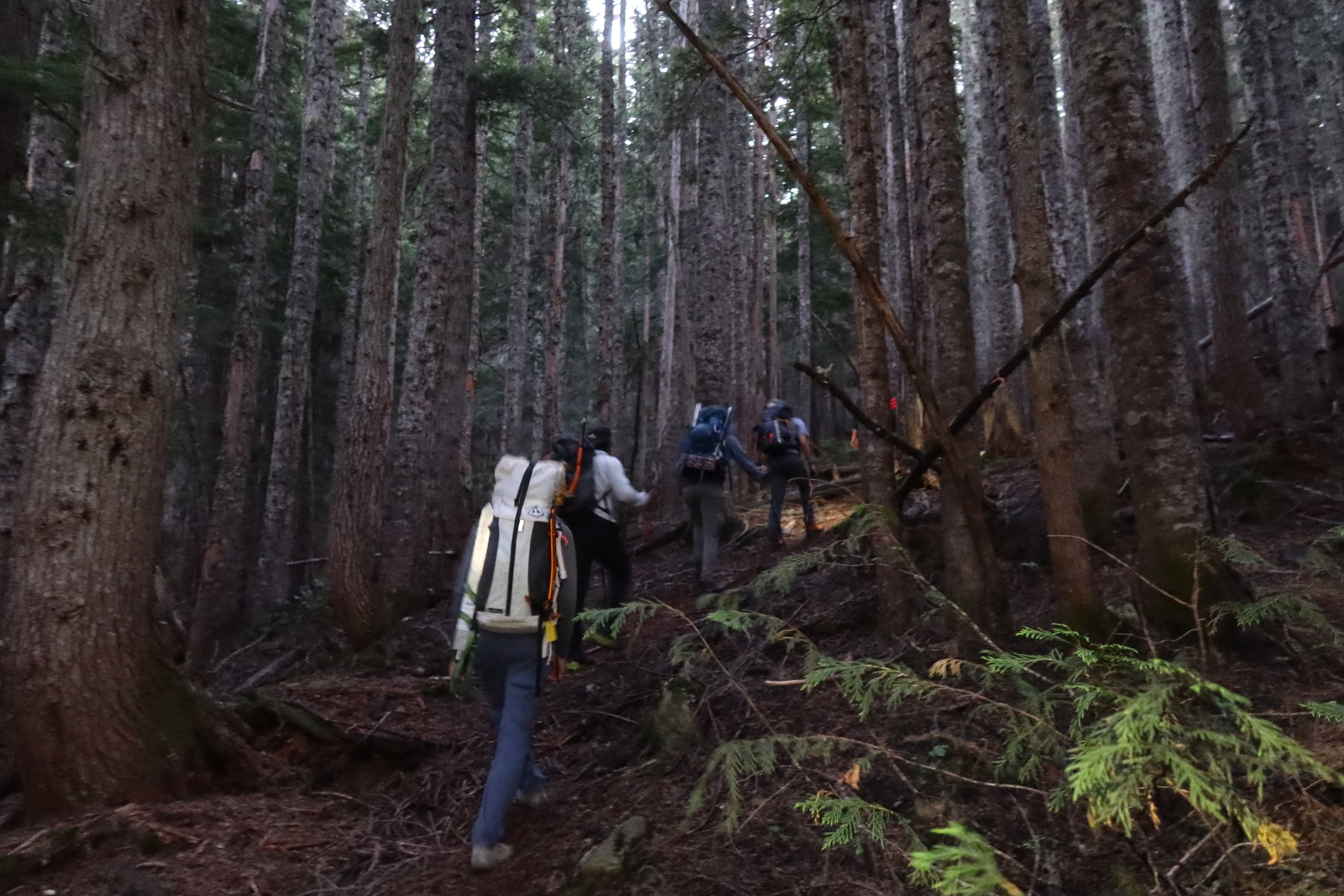
- Hike 1.5 miles, gaining 700′, on the old Bedal Creek trail, which is overgrown in sections. It’s always clear enough to follow and be able to hike rather briskly, but you will be brushing up against the brush through quite a few sections.
- 3500ish – 5:00am – find climber’s trail, which turns off left (at 48.05601, -121.36307) At least in 2024, it’s well-marked with pink flagging tape.
- gain 1400′ rather straight up through the forest on a climber’s trail that has become rather well-defined.
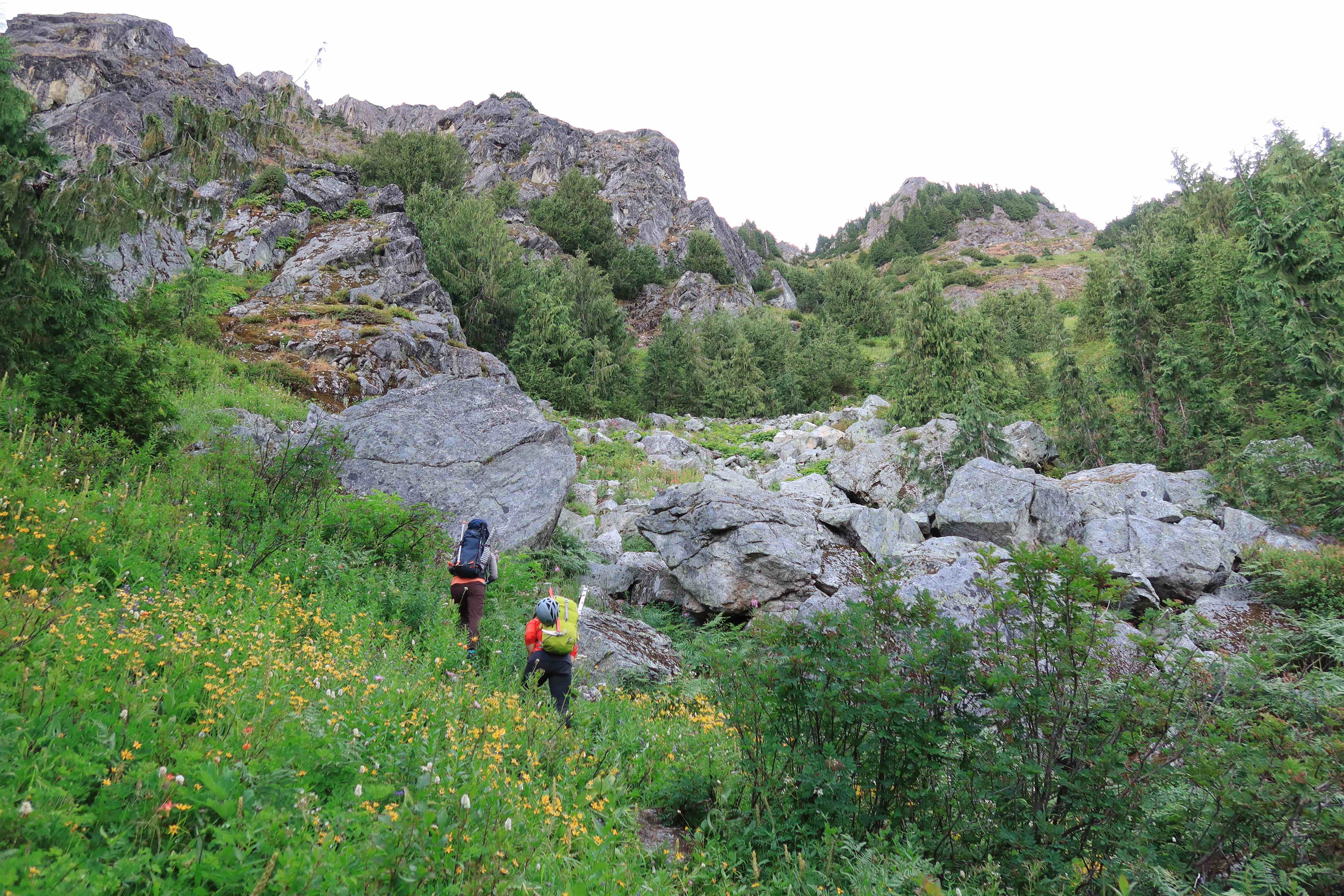
- 4900′ – 6:15am – exit the forest, in a talus field very briefly
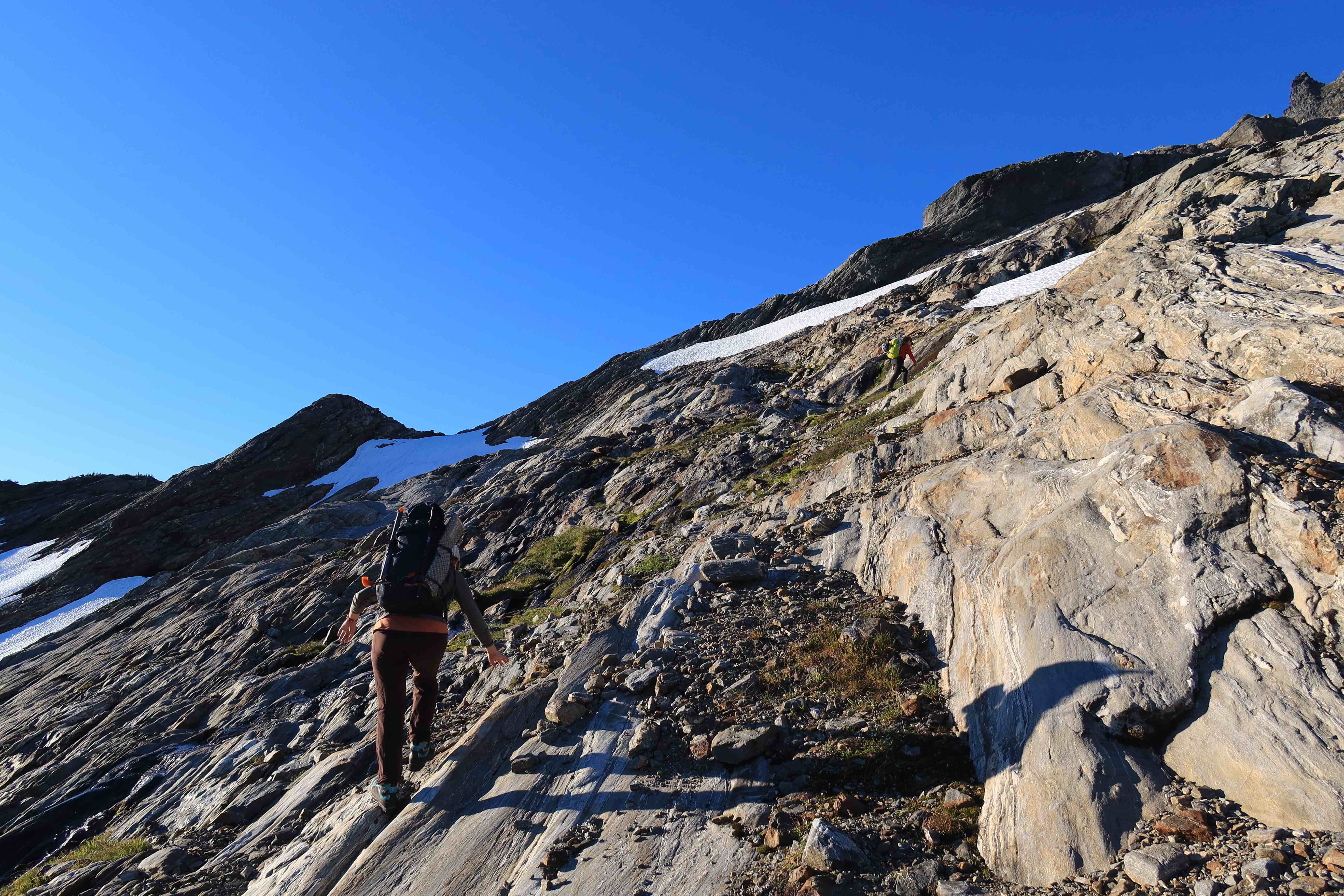
- the route turns right (southeast) and continues to follow a reasonably-well-defined climbers trail, traversing through a meadow with views of the summit, also passing briefly through another bit of forest
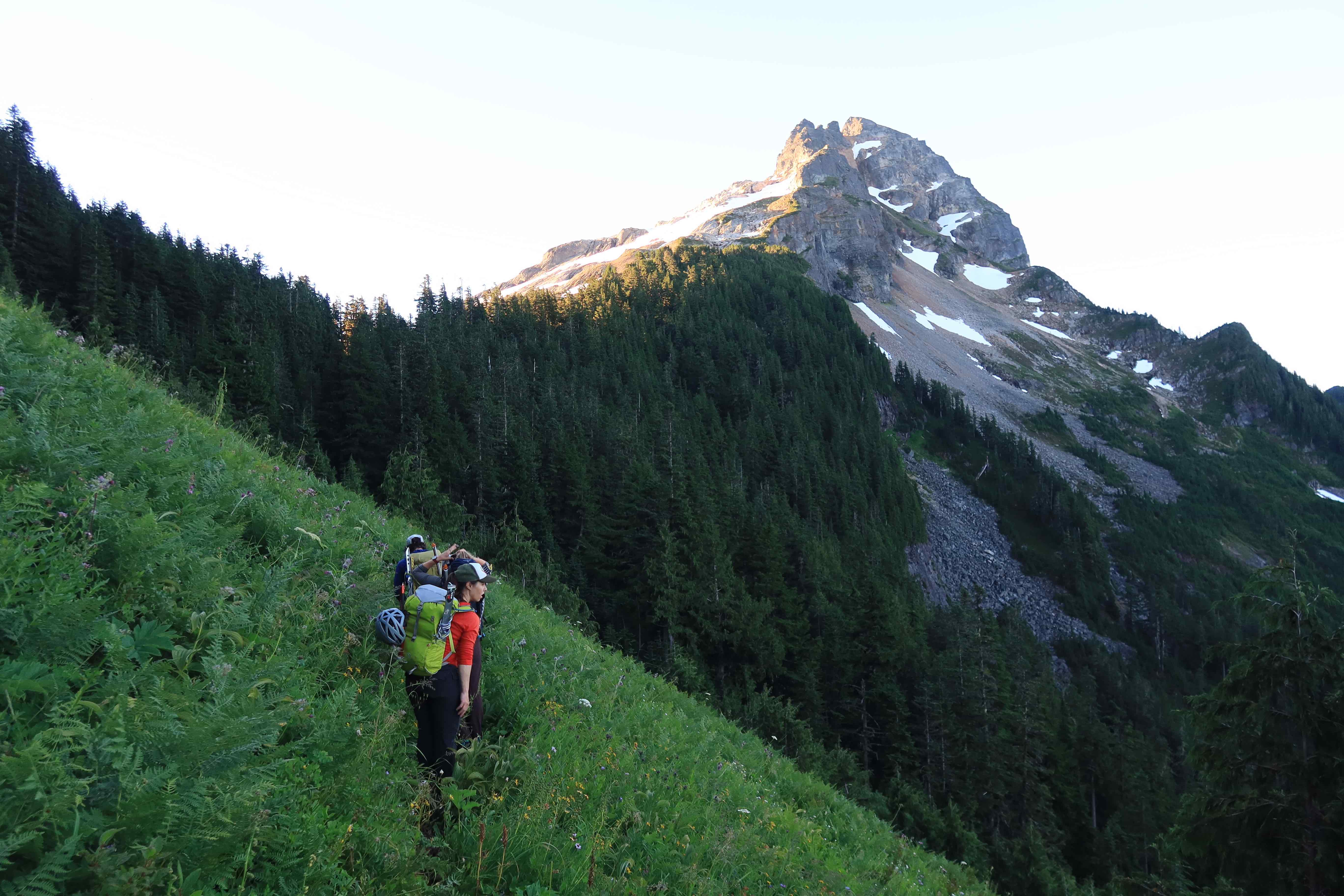
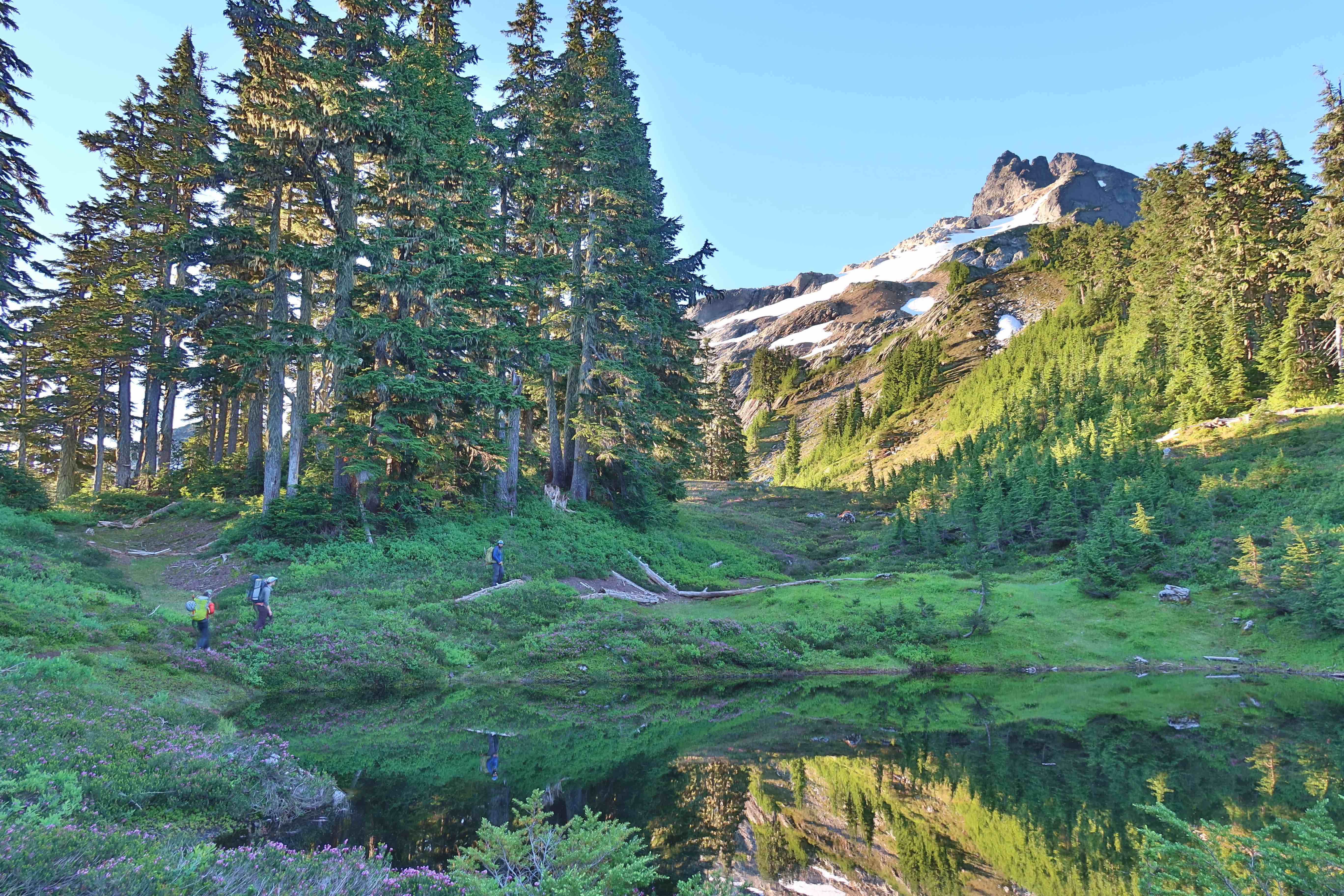
- 5300′ – 6:45am – at the Bedal/Sloan Saddle, passing by a pond that’s a bit stagnant (optional campsite nearby)
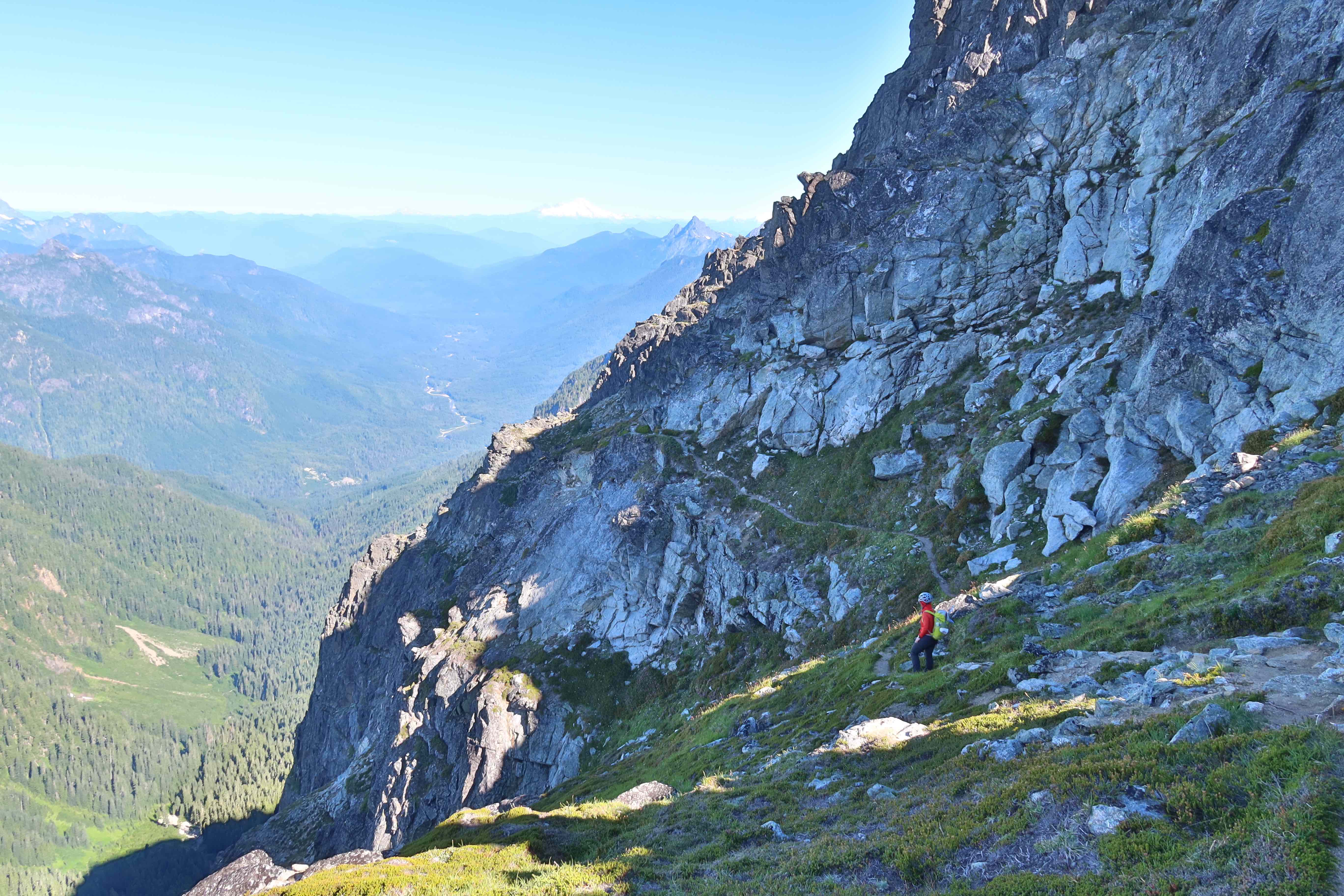
- now on the northeastern aspect of the mountain, continue traveling southeast on increasingly open and rocky scramble terrain. Somewhere in here is a good time to put on helmets. Many little cascades of water provide opportunities to filter and refill here. At some point, you’ll get on snow, which tends to be firm in the morning, and may require ice axe & crampons.
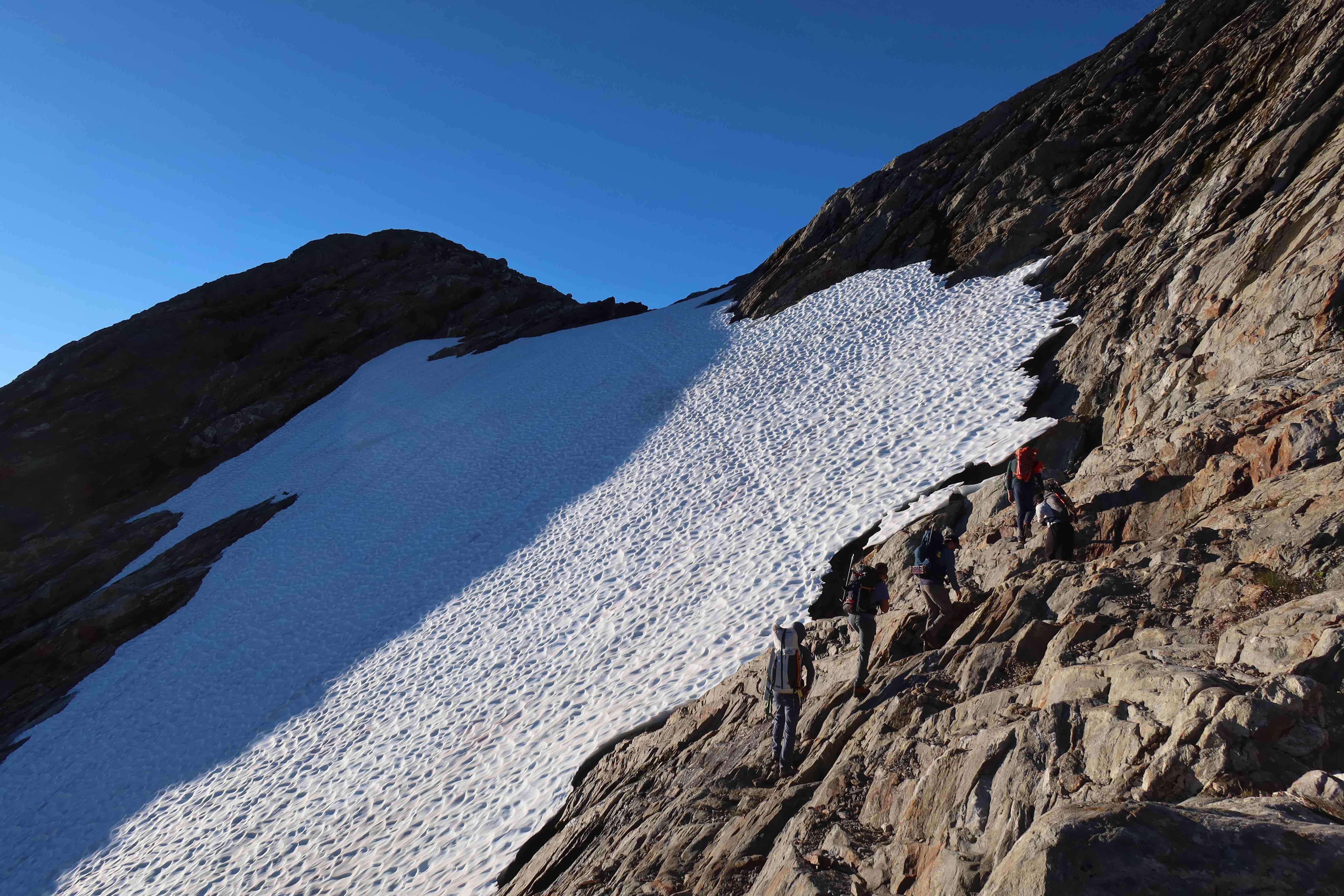
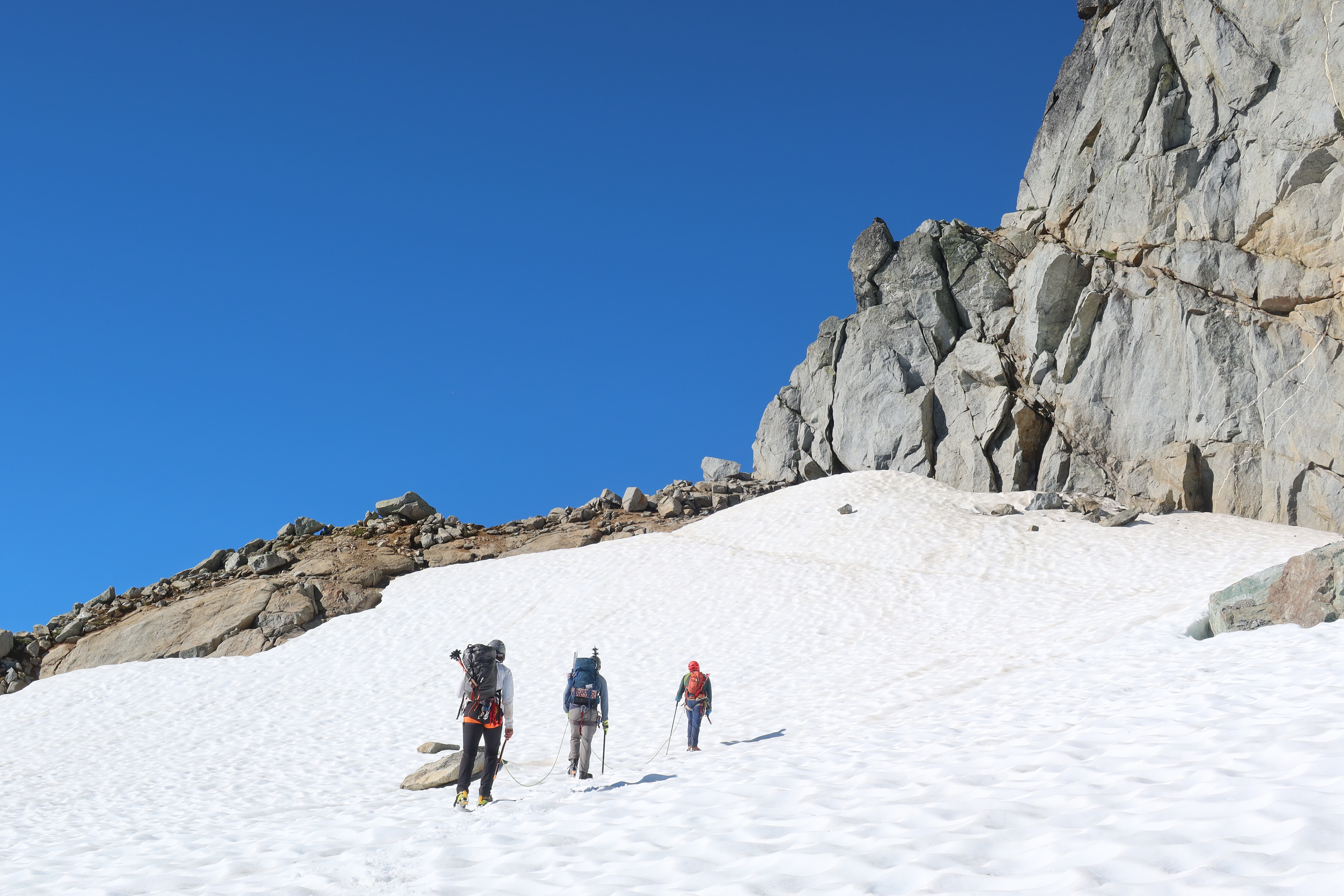
- 5800′ – 8:00am – cross over a minor rock ridge, and get your first views of the glacier
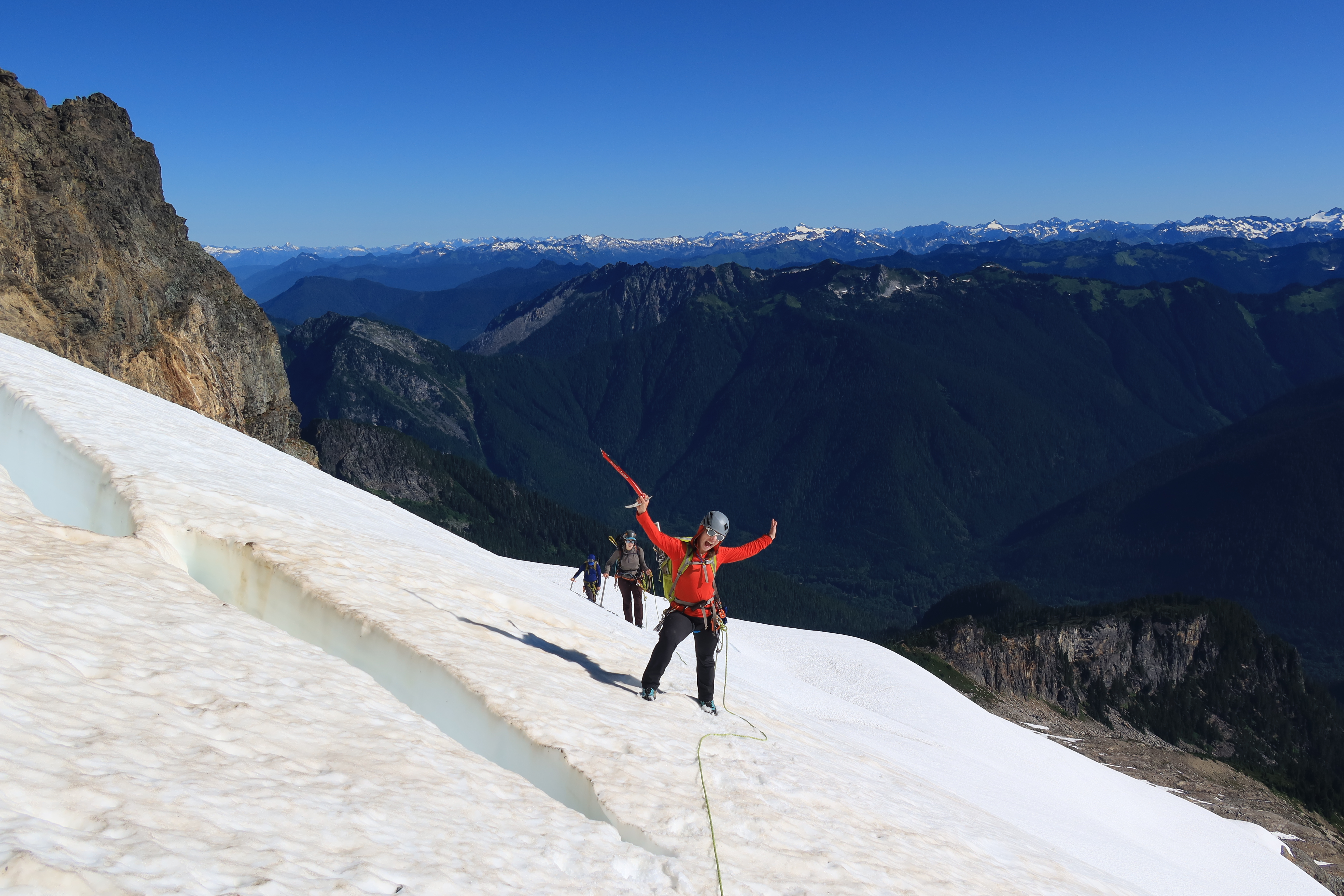
- 30 minutes to rope up, about 1h15m to 1h30m of glacier travel to fully cross the glacier
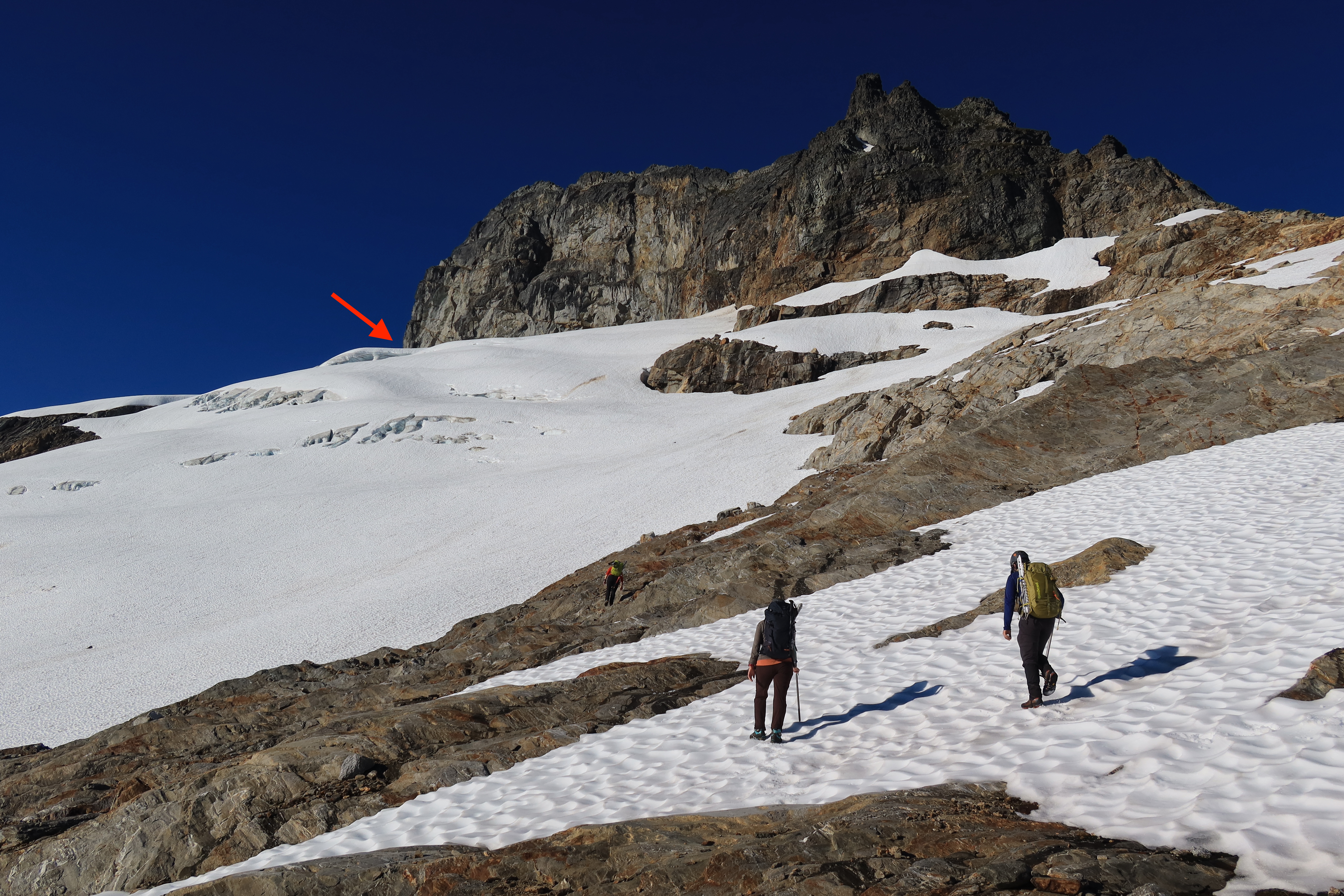
- 7300′ – 10:00am – finish the glacier
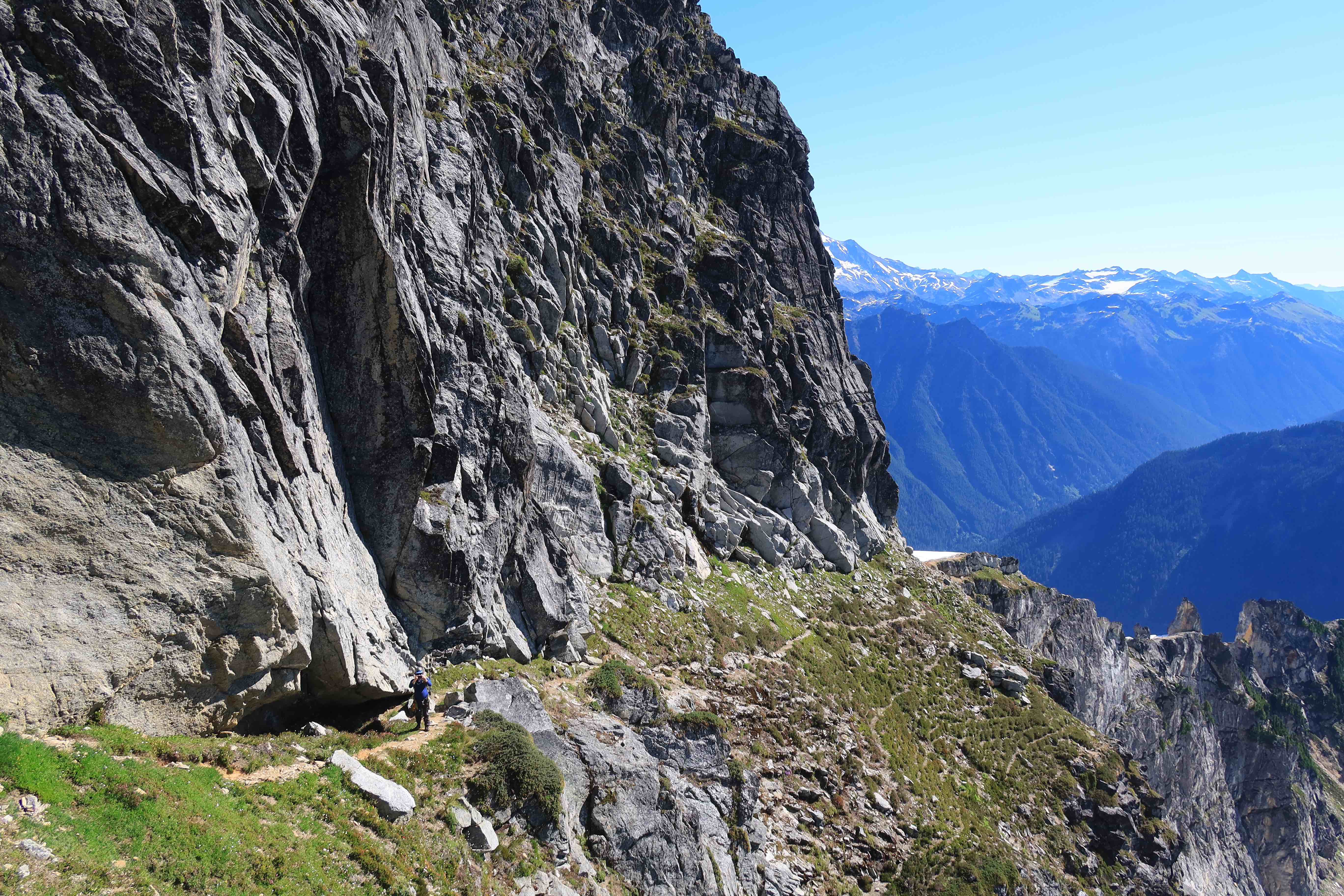
- After stepping off the glacier, you can cache all of your glacier & snow gear here to retrieve later (harnesses, rope, pickets, ice axe, crampons, etc.) From here, the route follows trails on stunning heather ledges. The trails are easy-walking, but the exposure is wild, so move carefully.
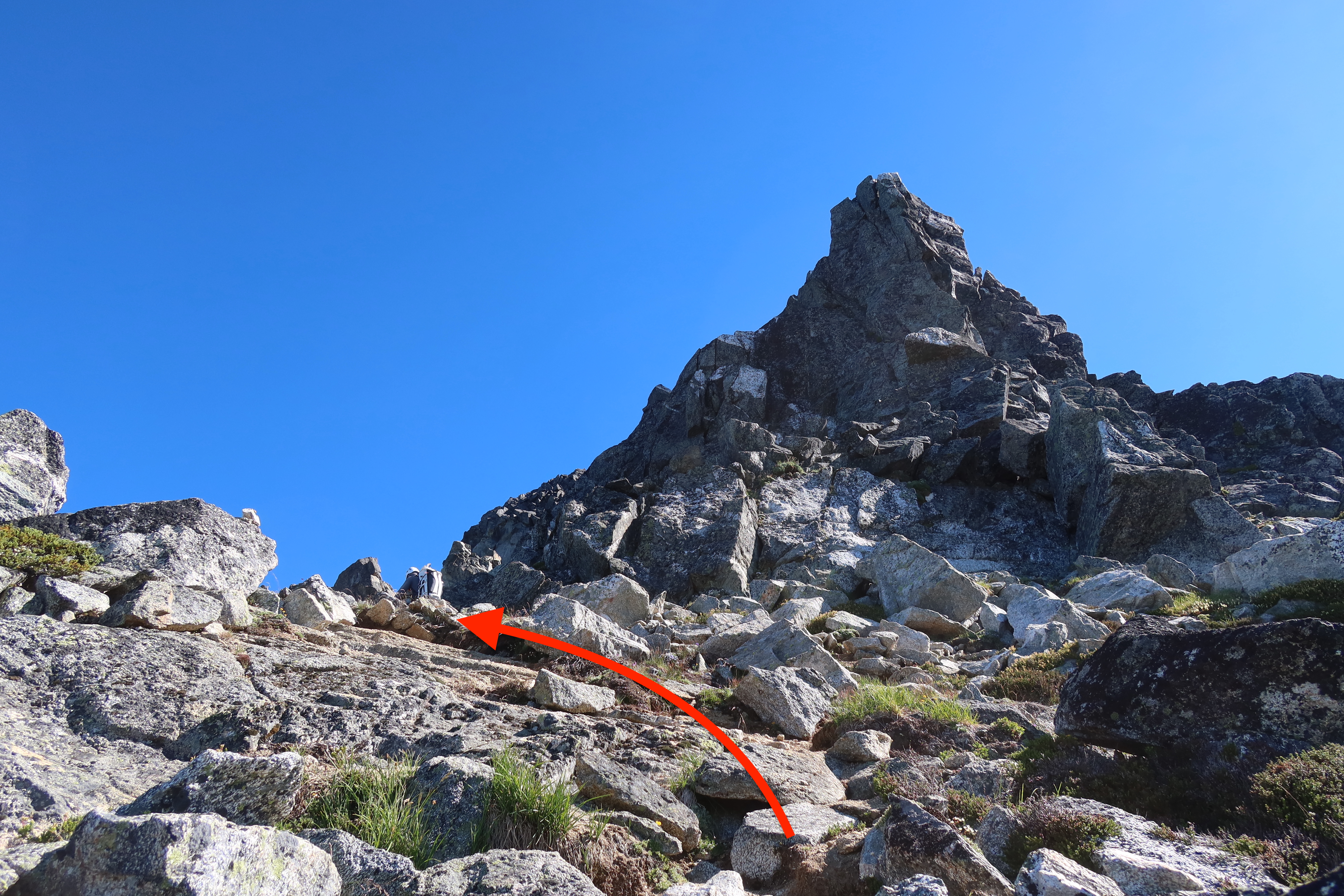
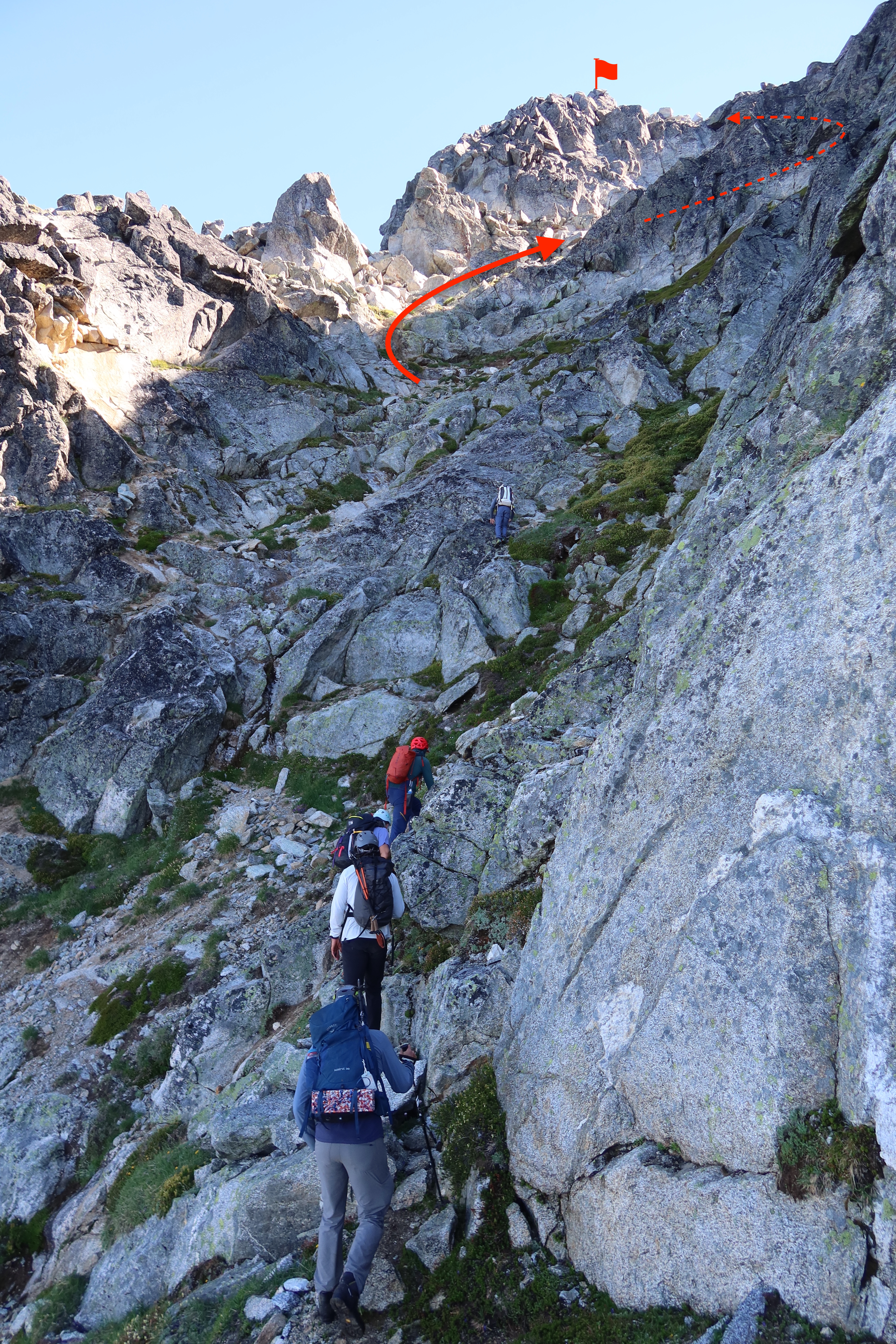
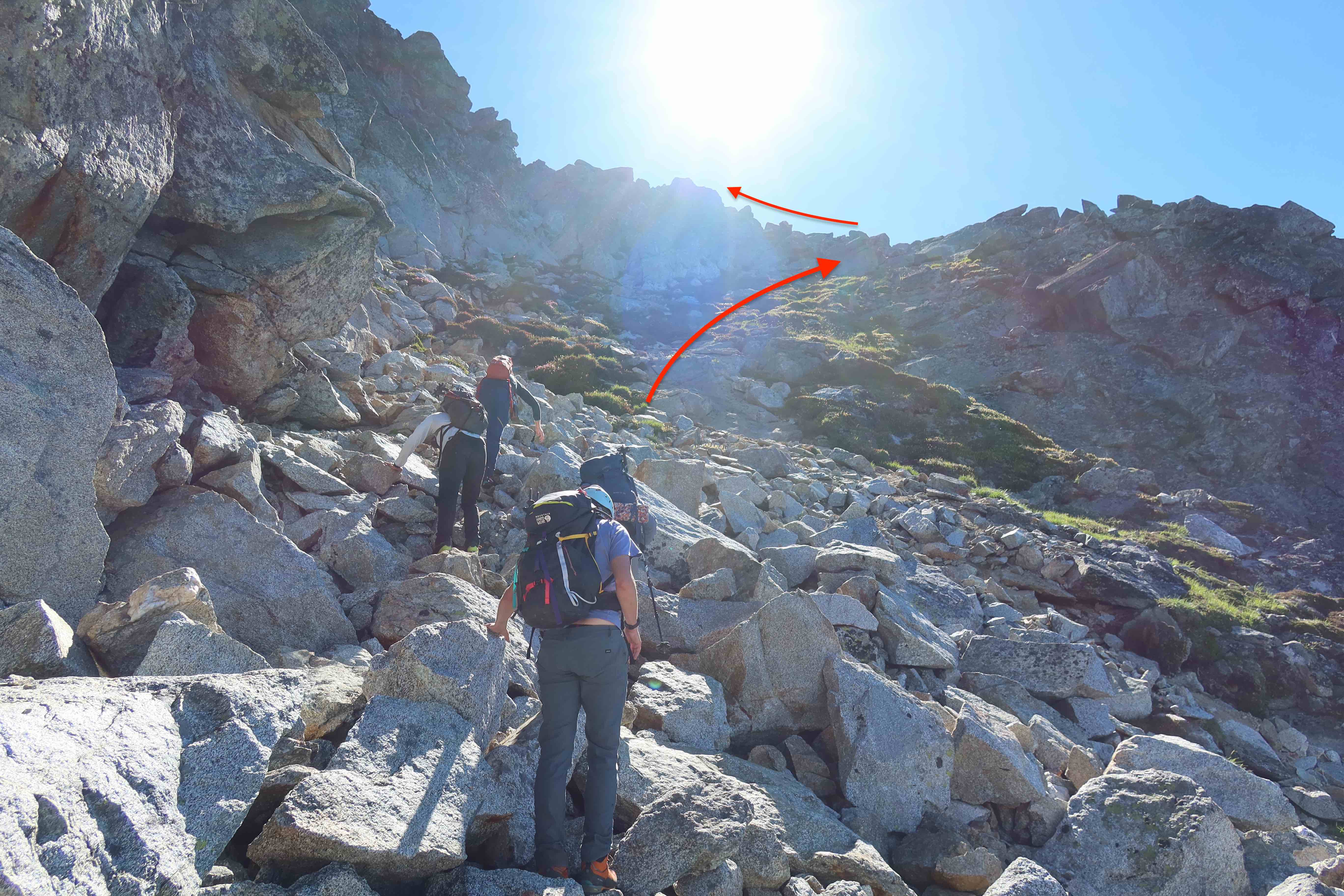
- Once you’ve followed those trails on heather-ledges for about 10 to 15 minutes, and they’ve taken you 180° around the mountain, so you’re now on Sloan’s west aspect, the opposite side from where the glacier was: watch to your right for a gulley of white rocks. Go up that. The rocks in there are loose, so be mindful of team-members who are below. At the top of the white-rock-gully, turn left and keep scrambling up.
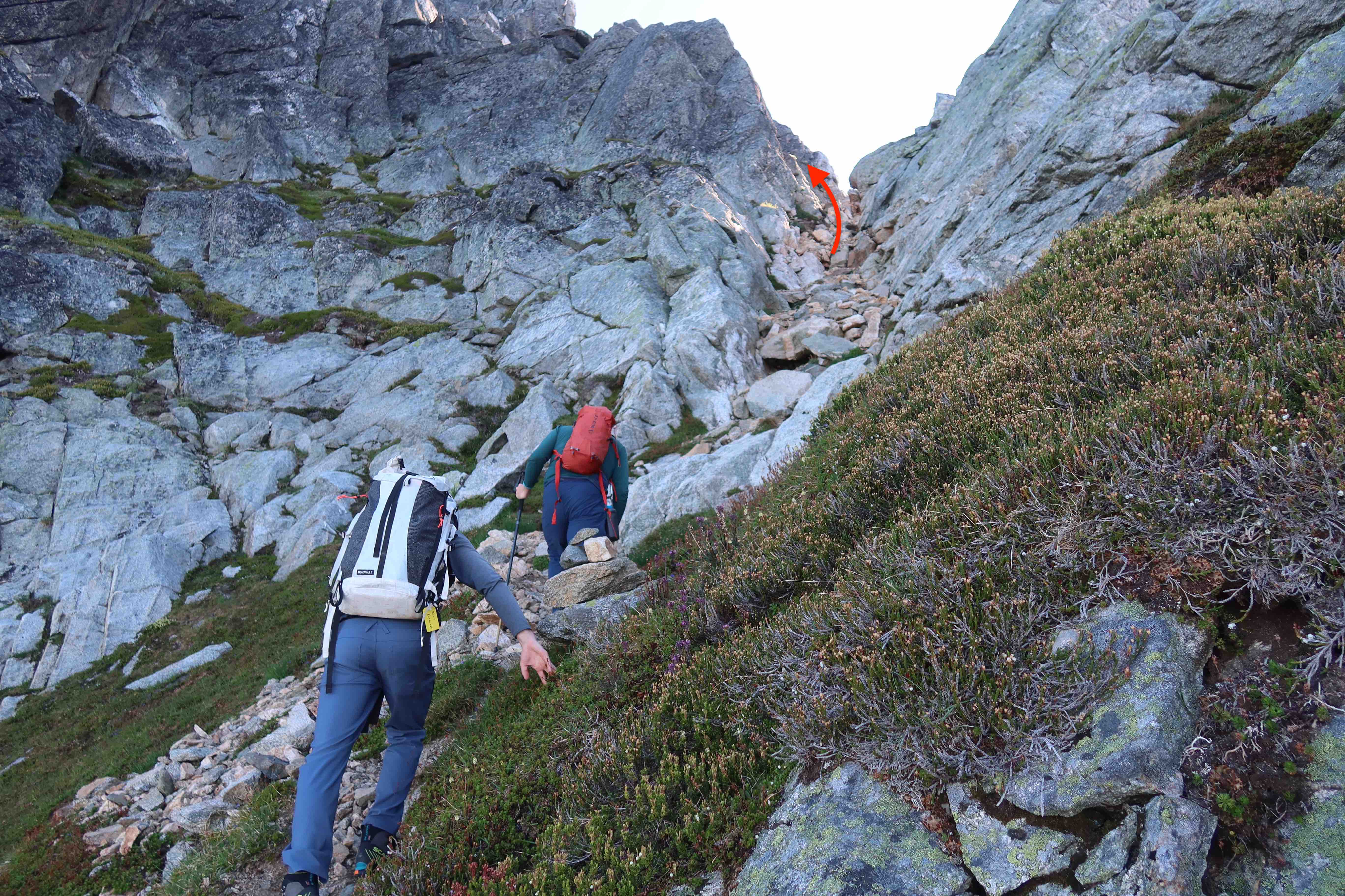
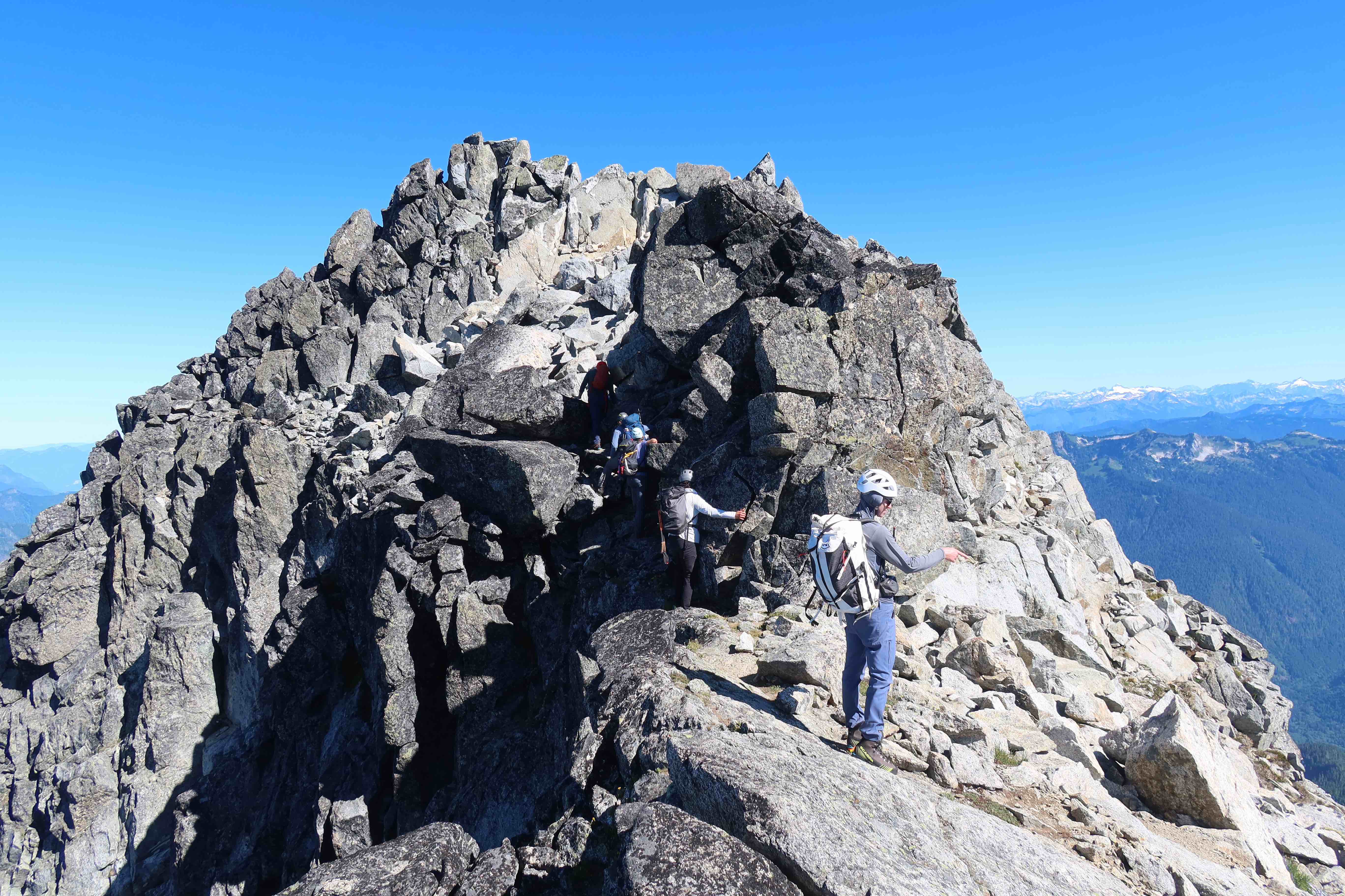
- After travelling left for a few minutes, a second, much broader gully-ish area provides on and off trails & scrambling up towards the summit.
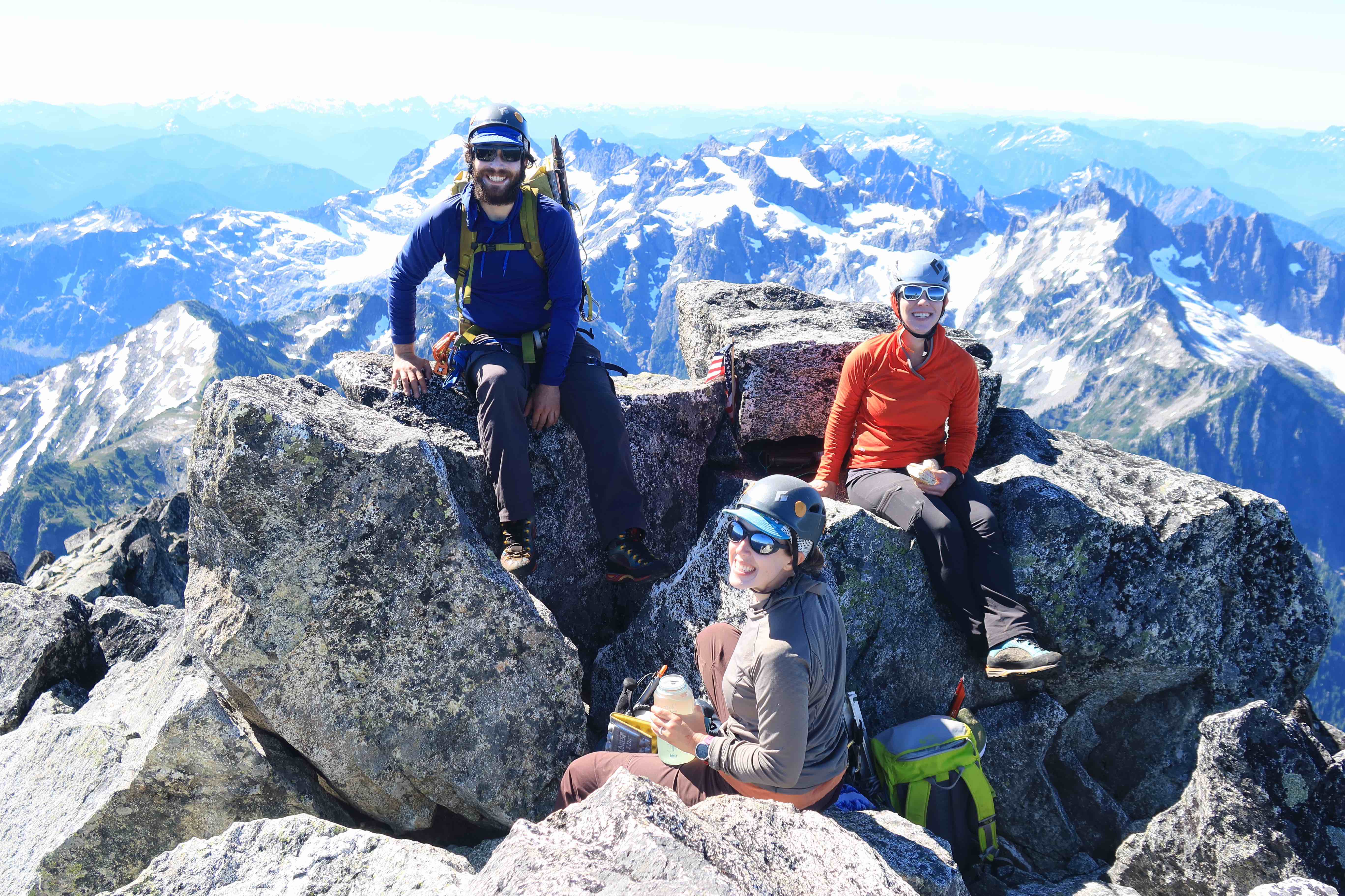
- 7835′ – 11:00am – summit
- 30 minute summit-break. Perhaps start heading back down at 11:30am
- 7300′ – 12:15pm – arrive back at the glacier. Rope back up and retrace your steps back down.
- 6200′ – 1:30pm – off the glacier, packing away the ropes & harnesses
- 5300′ – 2:30pm – back at the Bedal/Sloan Saddle, near the pond
- 3500ish – 4:00pm – back on the Bedal Creek trail, along the valley bottom
- 2800′ – 4:45pm – back at trailhead
Route Detail Pictures

Hey great writeup! did your vehicle get scratched up pretty good getting to the trailhead?
Yeah, there is a ton of contact with brush & branches that are trying to overgrow the road there in from the sides, and my Subaru Forester did get a couple new minor/light scratches from the drive. But nothing too bad, I don’t really find the scratches all that noticeable now, unless I’m really looking closely for them. Though I very much have a “tools not jewels” mentality about my car, so it’s possible I’m just biased towards not-noticing scratches in general.
(Though that road is in dire need of some official maintenance. I wish the state would go through there with something like a tractor with a boom-mower to give that road corridor some breathing room, in addition to also doing some major re-grading work to level out the roadbed itself. Perhaps we should figure out what agency is responsible for that road and send them some polite email requests to that effect, since they probably don’t even know how much climbers actually use that road, I don’t think they have any way to collect statistics on it other than seeing that it gets roughly one WTA trip report per year.)